Katra night lights from space
Night Light of Katra (Uttar Pradesh) from space (India) Src. Average luminocity for 10x10km area is 5.1528% and for 50x50km: 7.6296%.
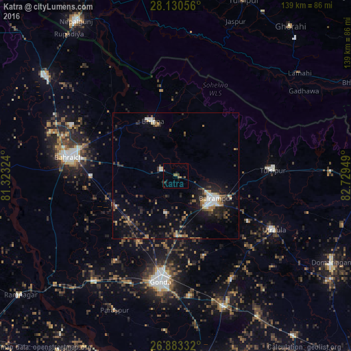
Analysis of Katra night lights 2016
Square area 10x10 km:
 0%
0%90-99
0%80-89
0%70-79
0.4%60-69
1.59%50-59
1.98%40-49
0.79%30-39
1.39%20-29
1.79%10-19
2.18%0-9
89.88%Square area 50x50 km:
0.86%90-99
0.75%80-89
0.55%70-79
0.55%60-69
0.99%50-59
1.06%40-49
1.42%30-39
1.85%20-29
2.94%10-19
5.31%0-9
83.71%Clear (daylight) street map image can be seen on geolist.org.
Map coordinates:
28° 7' 50" North, 81° 19' 23.7" East
27° 30' 31.4" North, 82° 1' 34.9" East
26° 52' 60" North, 82° 43' 46.2" East
Some cities around Katra sort by population:
• Bahraigh
43.2 km =26.8 mi,  279°
279°
• Gondā City
42.5 km =26.4 mi,  189°
189°
• Balrāmpur
18 km =11.2 mi,  119°
119°
• Utraula
44.1 km =27.4 mi, 118°
• Tulsīpur
38.6 km =24 mi,  85°
85°
• Bhinga
23.4 km =14.5 mi,  337°
337°
• Ikauna
6.2 km =3.9 mi,  293°
293°
• Khargupur
15.2 km =9.4 mi, 194°
1267449 (p: 6,853)
Sources (retrieved 2019-11-25):
» Earth at Night: Flat Maps 2012, 2016