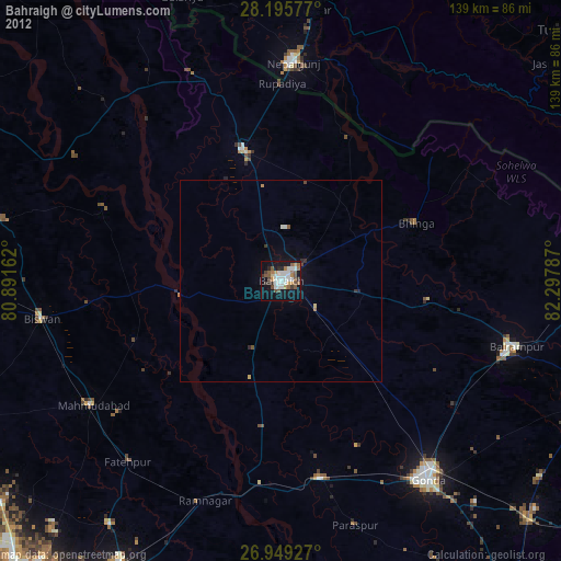
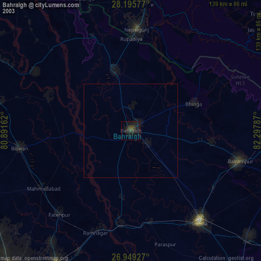
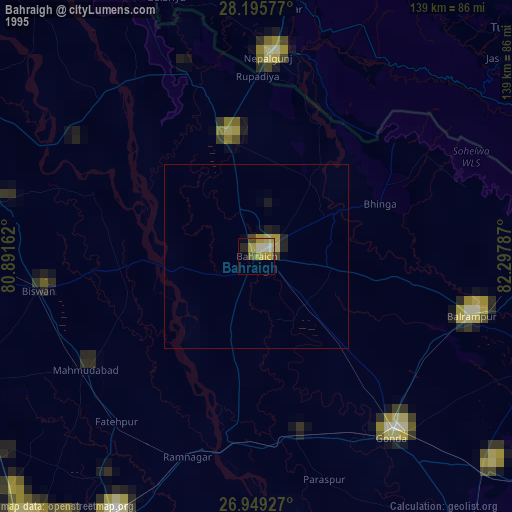
Bahraigh night lights from space
Night Light of Bahraigh (Uttar Pradesh) from space (India) Src. Average luminocity for 10x10km area is 68.0298% and for 50x50km: 8.3014%.
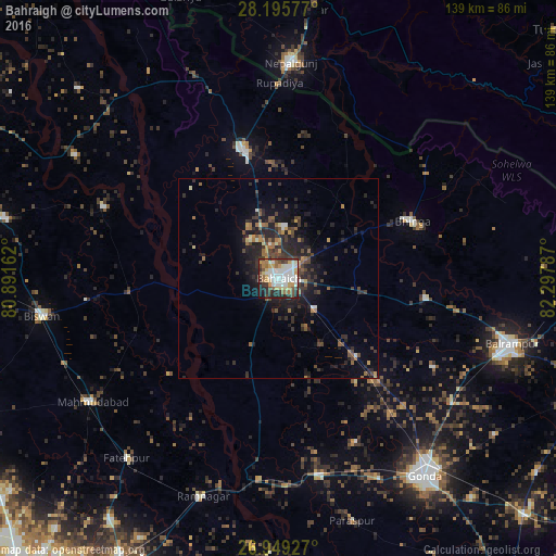
Analysis of Bahraigh night lights 2016
Square area 10x10 km:
 19.05%
90-99
19.44%80-89
6.94%70-79
8.33%60-69
8.73%50-59
4.76%40-49
6.94%30-39
9.33%20-29
11.31%10-19
5.16%0-9
0%Square area 50x50 km:
0.83%90-99
1.04%80-89
0.53%70-79
0.87%60-69
1.13%50-59
1.07%40-49
1.72%30-39
2.13%20-29
4.02%10-19
5.73%0-9
80.93%Clear (daylight) street map image can be seen on geolist.org.
Map coordinates:
28° 11' 44.8" North, 80° 53' 29.8" East
27° 34' 27.4" North, 81° 35' 41.1" East
26° 56' 57.4" North, 82° 17' 52.3" East
Some cities around Bahraigh sort by population:
• Nepalgunj, NP
52.9 km =32.9 mi,  2°
2°
• Nānpāra
33.6 km =20.9 mi,  343°
343°
• Colonelganj
50 km =31.1 mi,  168°
168°
• Bhinga
36.4 km =22.6 mi,  66°
66°
• Jarwal
46 km =28.6 mi,  186°
186°
• Ikauna
37.2 km =23.1 mi,  97°
97°
• Khargupur
44.6 km =27.7 mi,  119°
119°
• Katra
43.2 km =26.8 mi, 99°
1277799 (p: 182,218)
Sources (retrieved 2019-11-25):
» NASA, Earths city lights 1995
» NASA city lights 2003
» Earth at Night: Flat Maps 2012, 2016