Balrāmpur night lights from space
Night Light of Balrāmpur (Uttar Pradesh) from space (India) Src. Average luminocity for 10x10km area is 53.8106% and for 50x50km: 8.9714%.
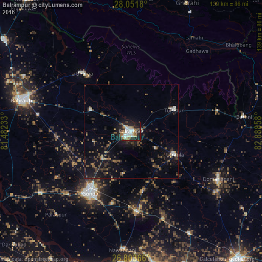
Analysis of Balrāmpur night lights 2016
Square area 10x10 km:
 15.53%
90-99
11.36%80-89
5.87%70-79
4.73%60-69
6.44%50-59
6.63%40-49
3.79%30-39
4.73%20-29
18.18%10-19
21.21%0-9
1.52%Square area 50x50 km:
0.96%90-99
0.98%80-89
0.48%70-79
0.49%60-69
1.02%50-59
1.31%40-49
1.68%30-39
2.39%20-29
3.53%10-19
8.01%0-9
79.15%Clear (daylight) street map image can be seen on geolist.org.
Map coordinates:
28° 3' 6.5" North, 81° 28' 56.4" East
27° 25' 46.2" North, 82° 11' 7.6" East
26° 48' 13.2" North, 82° 53' 18.9" East
Some cities around Balrāmpur sort by population:
• Gondā City
40.3 km =25 mi,  214°
214°
• Utraula
26.1 km =16.2 mi,  118°
118°
• Tulsīpur
25.6 km =15.9 mi,  63°
63°
• Bhinga
39.2 km =24.4 mi,  320°
320°
• Ikauna
24.1 km =15 mi,  297°
297°
• Mankāpur
42.2 km =26.2 mi,  174°
174°
• Khargupur
20.4 km =12.7 mi,  253°
253°
• Katra
18 km =11.2 mi, 299°
1277525 (p: 77,396)
Sources (retrieved 2019-11-25):
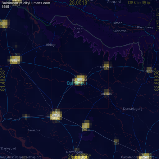
» NASA, Earths city lights 1995
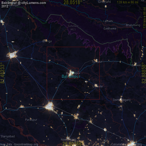
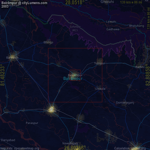
» NASA city lights 2003
» Earth at Night: Flat Maps 2012, 2016