Karwar night lights from space
Night Light of Karwar (Karnataka) from space (India) Src. Average luminocity for 10x10km area is 43.1302% and for 50x50km: 4.4547%.
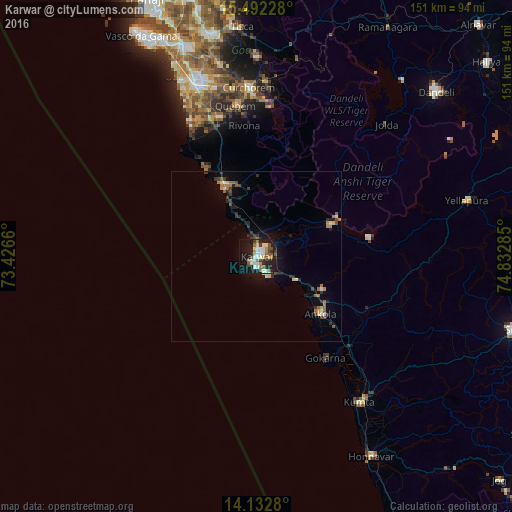
Analysis of Karwar night lights 2016
Square area 10x10 km:
 8.47%
8.47%90-99
11.78%80-89
4.13%70-79
2.69%60-69
5.79%50-59
6.2%40-49
3.72%30-39
5.17%20-29
8.88%10-19
32.85%0-9
10.33%Square area 50x50 km:
0.36%90-99
0.76%80-89
0.42%70-79
0.45%60-69
0.56%50-59
0.68%40-49
0.55%30-39
0.98%20-29
1.03%10-19
2.94%0-9
91.26%Clear (daylight) street map image can be seen on geolist.org.
Map coordinates:
15° 29' 32.2" North, 73° 25' 35.8" East
14° 48' 49" North, 74° 7' 47" East
14° 7' 58.1" North, 74° 49' 58.3" East
Some cities around Karwar sort by population:
• Gokarna
35.5 km =22.1 mi,  145°
145°
• Cuncolim
43 km =26.7 mi,  340°
340°
• Ankola
25.4 km =15.8 mi,  132°
132°
• Quepem
44.7 km =27.8 mi,  352°
352°
• Kānkon
25.4 km =15.8 mi, 339°
• Cavelossim
44.7 km =27.8 mi,  333°
333°
• Canacona
22 km =13.7 mi, 337°
• Sanguem
46.2 km =28.7 mi,  2°
2°
1267635 (p: 64,457)
Sources (retrieved 2019-11-25):
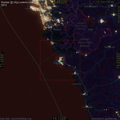
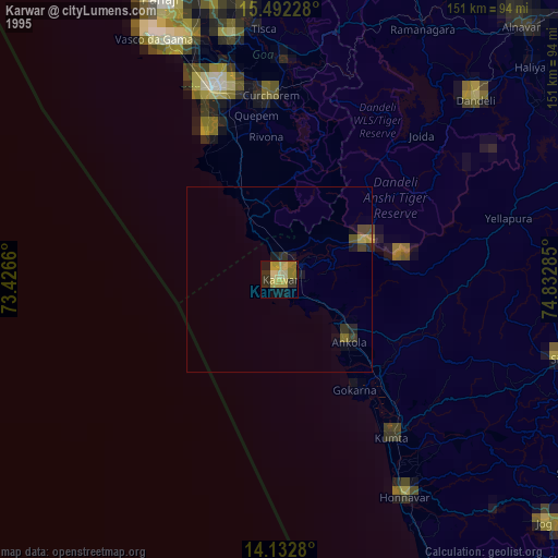
» NASA, Earths city lights 1995
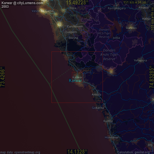
» NASA city lights 2003
» Earth at Night: Flat Maps 2012, 2016