Jānsath night lights from space
Night Light of Jānsath (Uttar Pradesh) from space (India) Src. Average luminocity for 10x10km area is 28.7538% and for 50x50km: 28.7985%.
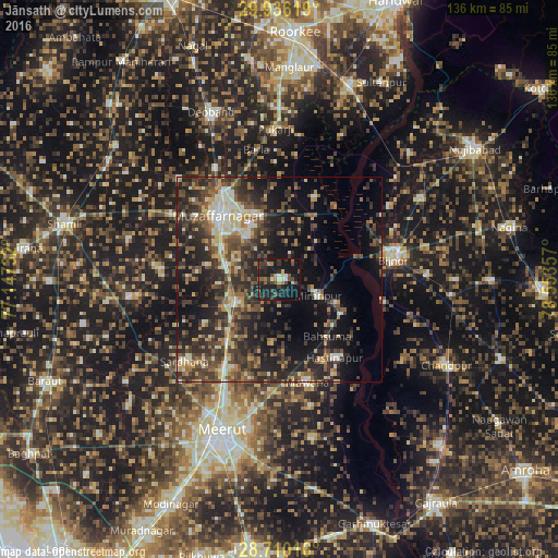
Analysis of Jānsath night lights 2016
Square area 10x10 km:
 0.38%
0.38%90-99
4.17%80-89
2.08%70-79
2.27%60-69
4.17%50-59
2.46%40-49
9.09%30-39
8.14%20-29
10.42%10-19
50%0-9
6.82%Square area 50x50 km:
1.85%90-99
3.79%80-89
3.61%70-79
2.91%60-69
3.73%50-59
4.97%40-49
7.97%30-39
7.75%20-29
12.24%10-19
19.47%0-9
31.71%Clear (daylight) street map image can be seen on geolist.org.
Map coordinates:
29° 56' 10.3" North, 77° 8' 50.4" East
29° 19' 30.1" North, 77° 51' 1.6" East
28° 42' 36.6" North, 78° 33' 12.9" East
Some cities around Jānsath sort by population:
• Muzaffarnagar
21.6 km =13.4 mi,  318°
318°
• Mawāna
25.7 km =16 mi,  164°
164°
• Khatauli
12.5 km =7.8 mi,  245°
245°
• Mīrānpur
10.3 km =6.4 mi,  111°
111°
• Hastināpur
23.8 km =14.8 mi,  140°
140°
• Lāwar Khās
24.8 km =15.4 mi,  196°
196°
• Phalauda
15.3 km =9.5 mi,  187°
187°
• Bahsūma
18.2 km =11.3 mi, 139°
1269227 (p: 19,467)
Sources (retrieved 2019-11-25):
» Earth at Night: Flat Maps 2012, 2016