Hastināpur night lights from space
Night Light of Hastināpur (Uttar Pradesh) from space (India) Src. Average luminocity for 10x10km area is 27.1984% and for 50x50km: 22.9974%.
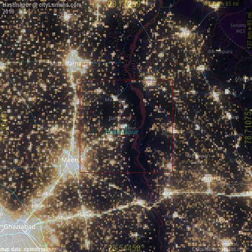
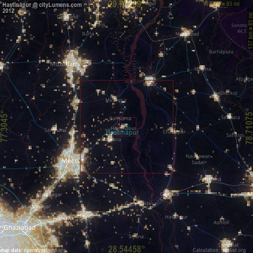
Analysis of Hastināpur night lights 2016
Square area 10x10 km:
 1.98%
1.98%90-99
4.76%80-89
2.18%70-79
3.77%60-69
1.79%50-59
4.17%40-49
4.76%30-39
6.75%20-29
13.49%10-19
27.58%0-9
28.77%Square area 50x50 km:
0.62%90-99
2.13%80-89
2.31%70-79
2.43%60-69
3.14%50-59
4.86%40-49
6.64%30-39
6.98%20-29
9.6%10-19
20.08%0-9
41.2%Clear (daylight) street map image can be seen on geolist.org.
Map coordinates:
29° 46' 21.3" North, 77° 18' 16.2" East
29° 9' 37.5" North, 78° 0' 27.4" East
28° 32' 40.5" North, 78° 42' 38.7" East
Some cities around Hastināpur sort by population:
• Mawāna
10.5 km =6.5 mi,  232°
232°
• Chāndpur
25.8 km =16 mi,  96°
96°
• Mīrānpur
15.5 km =9.6 mi,  338°
338°
• Lāwar Khās
23 km =14.3 mi,  256°
256°
• Jānsath
23.8 km =14.8 mi,  320°
320°
• Parīchhatgarh
21.5 km =13.4 mi,  199°
199°
• Phalauda
17.5 km =10.9 mi,  280°
280°
• Bahsūma
5.6 km =3.5 mi, 322°
1270237 (p: 24,093)
Sources (retrieved 2019-11-25):
» Earth at Night: Flat Maps 2012, 2016