Itārsi night lights from space
Night Light of Itārsi (Madhya Pradesh) from space (India) Src. Average luminocity for 10x10km area is 47.1326% and for 50x50km: 10.6622%.
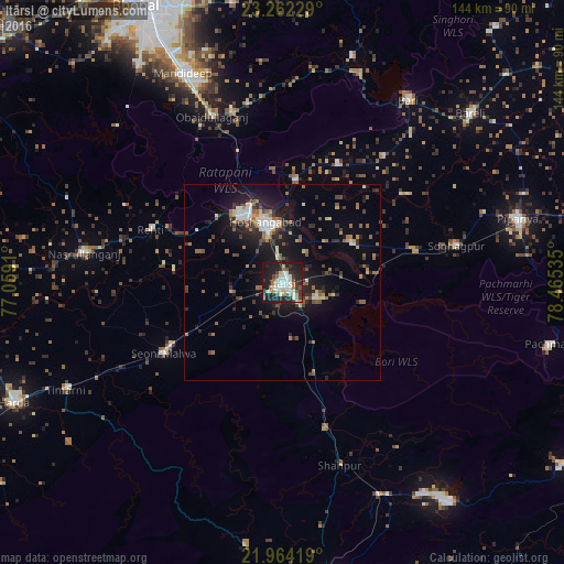
Analysis of Itārsi night lights 2016
Square area 10x10 km:
 9.66%
9.66%90-99
13.45%80-89
4.17%70-79
3.6%60-69
4.17%50-59
3.03%40-49
5.3%30-39
7.77%20-29
21.21%10-19
27.27%0-9
0.38%Square area 50x50 km:
1.06%90-99
1.7%80-89
0.89%70-79
0.71%60-69
1.6%50-59
1.66%40-49
1.6%30-39
1.7%20-29
3.66%10-19
8.73%0-9
76.69%Clear (daylight) street map image can be seen on geolist.org.
Map coordinates:
23° 15' 44.2" North, 77° 3' 32.8" East
22° 36' 53.2" North, 77° 45' 44" East
21° 57' 51.1" North, 78° 27' 55.3" East
Some cities around Itārsi sort by population:
• Hoshangābād
15.2 km =9.4 mi,  346°
346°
• Mandideep
57 km =35.4 mi,  335°
335°
• Seoni Mālwa
35.4 km =22 mi,  238°
238°
• Sohāgpur
45.4 km =28.2 mi,  77°
77°
• Nasrullāhganj
51 km =31.7 mi,  278°
278°
• Bābai
20.2 km =12.6 mi,  61°
61°
• Rehti
36.3 km =22.6 mi,  292°
292°
• Sultānpur
60.8 km =37.8 mi,  16°
16°
1269653 (p: 100,574)
Sources (retrieved 2019-11-25):
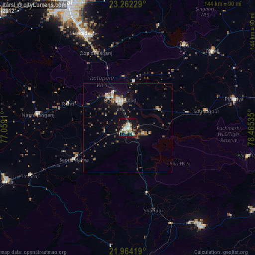
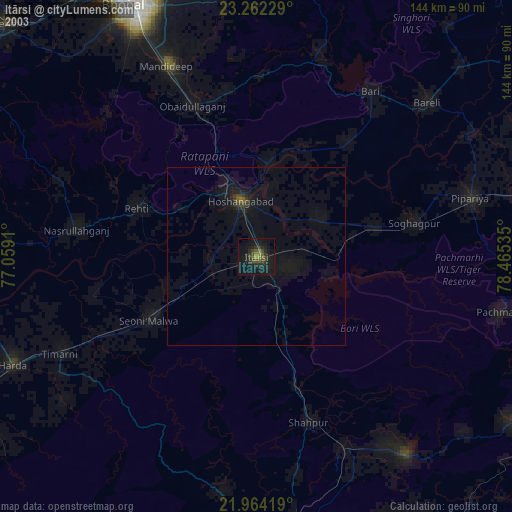
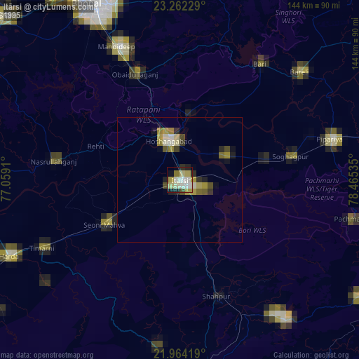
» NASA, Earths city lights 1995
» NASA city lights 2003
» Earth at Night: Flat Maps 2012, 2016