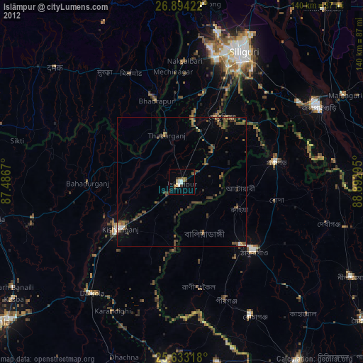
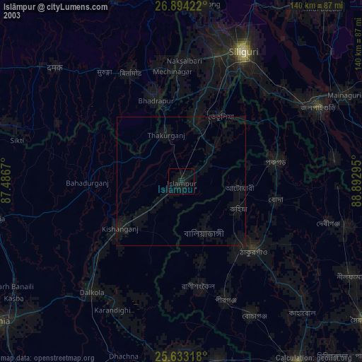
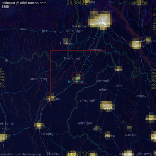
Islāmpur night lights from space
Night Light of Islāmpur (West Bengal) from space (India) Src. Average luminocity for 10x10km area is 20.5754% and for 50x50km: 5.4682%.
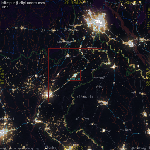
Analysis of Islāmpur night lights 2016
Square area 10x10 km:
 3.57%
3.57%90-99
3.97%80-89
0.99%70-79
0.6%60-69
1.39%50-59
3.37%40-49
3.97%30-39
5.16%20-29
2.38%10-19
11.11%0-9
63.49%Square area 50x50 km:
0.49%90-99
0.61%80-89
0.35%70-79
0.34%60-69
0.51%50-59
1.03%40-49
1.02%30-39
1.55%20-29
2.17%10-19
3%0-9
88.91%Clear (daylight) street map image can be seen on geolist.org.
Map coordinates:
26° 53' 39.2" North, 87° 29' 12.1" East
26° 15' 55.5" North, 88° 11' 23.4" East
25° 37' 59.4" North, 88° 53' 34.6" East
Some cities around Islāmpur sort by population:
• Kishanganj
29.6 km =18.4 mi,  232°
232°
• Thākurgaon, BD
38.2 km =23.7 mi,  132°
132°
• Naksalbāri
46.5 km =28.9 mi,  3°
3°
• Panchagarh, BD
37.4 km =23.2 mi,  78°
78°
• Pīrgaaj, BD
48.6 km =30.2 mi,  159°
159°
• Bahādurganj
36.4 km =22.6 mi,  269°
269°
• Bhadrapur, NP
32.4 km =20.1 mi,  342°
342°
• Thākurganj
18.9 km =11.7 mi, 342°
1269665 (p: 55,691)
Sources (retrieved 2019-11-25):
» NASA, Earths city lights 1995
» NASA city lights 2003
» Earth at Night: Flat Maps 2012, 2016