Bhadrapur night lights from space
Night Light of Bhadrapur (Province 1) from space (Nepal) Src. Average luminocity for 10x10km area is 9.0473% and for 50x50km: 6.4316%.
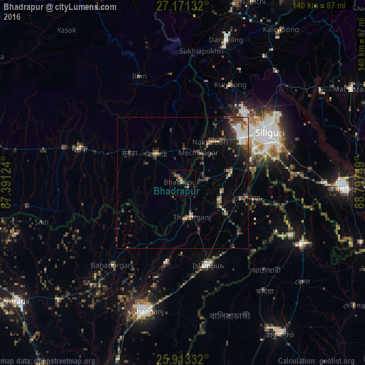
Analysis of Bhadrapur night lights 2016
Square area 10x10 km:
 0%
0%90-99
0.76%80-89
0.76%70-79
1.52%60-69
0%50-59
3.03%40-49
3.03%30-39
2.84%20-29
2.46%10-19
2.27%0-9
83.33%Square area 50x50 km:
0.59%90-99
0.75%80-89
0.42%70-79
0.7%60-69
0.63%50-59
1.15%40-49
1.3%30-39
1.73%20-29
2.72%10-19
2.75%0-9
87.26%Clear (daylight) street map image can be seen on geolist.org.
Map coordinates:
27° 10' 16.8" North, 87° 23' 28.5" East
26° 32' 38.5" North, 88° 5' 39.7" East
25° 54' 48" North, 88° 47' 51" East
Some cities around Bhadrapur sort by population:
• Siliguri, IN
38 km =23.6 mi,  60°
60°
• Naksalbāri, IN
19.8 km =12.3 mi,  39°
39°
• Islāmpur, IN
32.4 km =20.1 mi,  162°
162°
• Kārsiyāng, IN
41.8 km =26 mi,  25°
25°
• Bahādurganj, IN
41.3 km =25.7 mi,  220°
220°
• Bagdogra, IN
27.7 km =17.2 mi,  51°
51°
• Thākurganj, IN
13.5 km =8.4 mi, 164°
• Mirik, IN
39.4 km =24.5 mi,  13°
13°
1283628 (p: 19,523)
Sources (retrieved 2019-11-25):
» Earth at Night: Flat Maps 2012, 2016