Haraiya night lights from space
Night Light of Haraiya (Uttar Pradesh) from space (India) Src. Average luminocity for 10x10km area is 40.9306% and for 50x50km: 22.8754%.
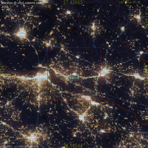
Analysis of Haraiya night lights 2016
Square area 10x10 km:
 2.58%
2.58%90-99
2.58%80-89
0.4%70-79
5.95%60-69
6.55%50-59
8.73%40-49
15.28%30-39
20.04%20-29
29.37%10-19
8.53%0-9
0%Square area 50x50 km:
0.95%90-99
1.35%80-89
0.93%70-79
1.93%60-69
3.07%50-59
4.73%40-49
7.2%30-39
8.27%20-29
13.27%10-19
22.03%0-9
36.27%Clear (daylight) street map image can be seen on geolist.org.
Map coordinates:
27° 25' 14.3" North, 81° 45' 40.5" East
26° 47' 41.2" North, 82° 27' 51.7" East
26° 9' 55.5" North, 83° 10' 3" East
Some cities around Haraiya sort by population:
• Fyzābād
31.3 km =19.4 mi,  266°
266°
• Bastī
25 km =15.5 mi,  91°
91°
• Tāndā
33.4 km =20.8 mi,  144°
144°
• Ajodhya
25.8 km =16 mi, 271°
• Nawābganj
33 km =20.5 mi,  283°
283°
• Bīkāpur
39.7 km =24.7 mi,  236°
236°
• Goshāinganj
26.2 km =16.3 mi,  198°
198°
• Mankāpur
36.9 km =22.9 mi,  320°
320°
1270391 (p: 9,000)
Sources (retrieved 2019-11-25):
» Earth at Night: Flat Maps 2012, 2016