Ajodhya night lights from space
Night Light of Ajodhya (Uttar Pradesh) from space (India) Src. Average luminocity for 10x10km area is 63.1647% and for 50x50km: 26.911%.
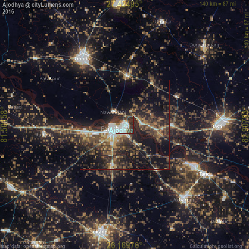
Analysis of Ajodhya night lights 2016
Square area 10x10 km:
 18.85%
90-99
20.63%80-89
2.98%70-79
1.98%60-69
3.77%50-59
5.75%40-49
10.52%30-39
10.12%20-29
25.4%10-19
0%0-9
0%Square area 50x50 km:
2.5%90-99
3.19%80-89
1.98%70-79
2.2%60-69
3.68%50-59
5.43%40-49
7.51%30-39
8.18%20-29
12.3%10-19
16.97%0-9
36.05%Clear (daylight) street map image can be seen on geolist.org.
Map coordinates:
27° 25' 29.8" North, 81° 30' 5.7" East
26° 47' 56.7" North, 82° 12' 16.9" East
26° 10' 11.1" North, 82° 54' 28.2" East
Some cities around Ajodhya sort by population:
• Fyzābād
6 km =3.7 mi,  244°
244°
• Gondā City
44.6 km =27.7 mi,  326°
326°
• Bastī
50.8 km =31.6 mi,  91°
91°
• Nawābganj
9.6 km =6 mi,  318°
318°
• Bīkāpur
23.8 km =14.8 mi,  197°
197°
• Goshāinganj
30.8 km =19.1 mi,  145°
145°
• Mankāpur
28.2 km =17.5 mi,  5°
5°
• Haraiya
25.8 km =16 mi, 91°
1278094 (p: 53,293)
Sources (retrieved 2019-11-25):
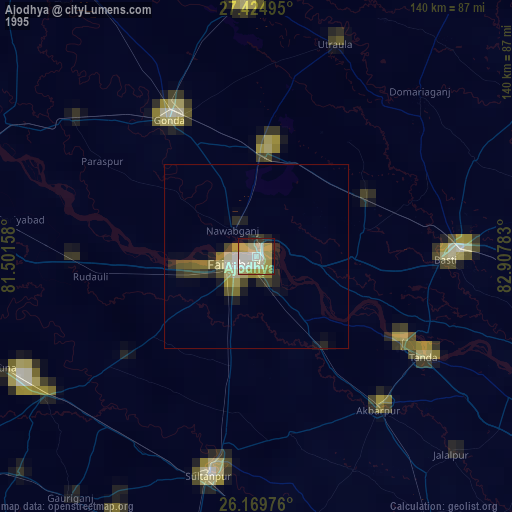
» NASA, Earths city lights 1995
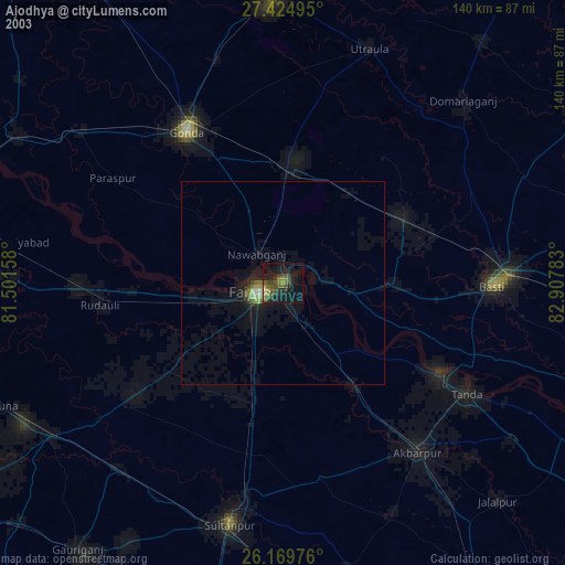
» NASA city lights 2003
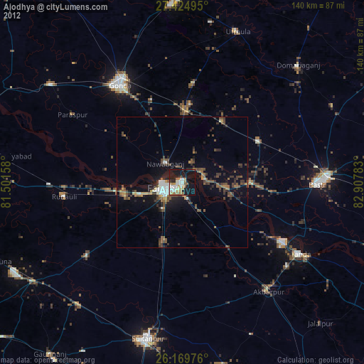
» Earth at Night: Flat Maps 2012, 2016