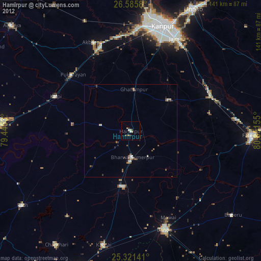
Hamīrpur night lights from space
Night Light of Hamīrpur (Uttar Pradesh) from space (India) Src. Average luminocity for 10x10km area is 12.756% and for 50x50km: 3.9204%.
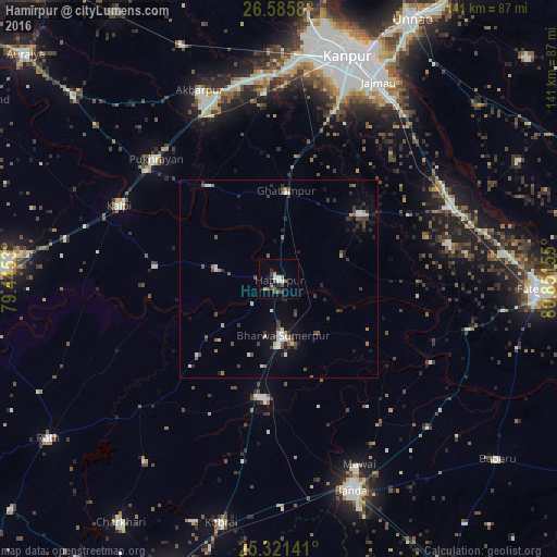
Analysis of Hamīrpur night lights 2016
Square area 10x10 km:
 1.39%
1.39%90-99
1.79%80-89
0%70-79
2.38%60-69
0.79%50-59
3.97%40-49
2.18%30-39
1.79%20-29
2.38%10-19
0.99%0-9
82.34%Square area 50x50 km:
0.44%90-99
0.56%80-89
0.23%70-79
0.26%60-69
0.4%50-59
0.62%40-49
0.78%30-39
0.8%20-29
1%10-19
1.76%0-9
93.14%Clear (daylight) street map image can be seen on geolist.org.
Map coordinates:
26° 35' 8.9" North, 79° 26' 43.1" East
25° 57' 19.1" North, 80° 8' 54.3" East
25° 19' 17.1" North, 80° 51' 5.6" East
Some cities around Hamīrpur sort by population:
• Kālpi
45.2 km =28.1 mi,  293°
293°
• Ghātampur
22 km =13.7 mi,  5°
5°
• Maudaha
30.5 km =19 mi,  186°
186°
• Bindki
43.7 km =27.2 mi,  78°
78°
• Pukhrāyān
43.1 km =26.8 mi,  313°
313°
• Kadaura
31.2 km =19.4 mi,  276°
276°
• Kurāra
16.1 km =10 mi, 280°
• Bahua
49.1 km =30.5 mi,  105°
105°
1270455 (p: 34,144)
Sources (retrieved 2019-11-25):
» Earth at Night: Flat Maps 2012, 2016