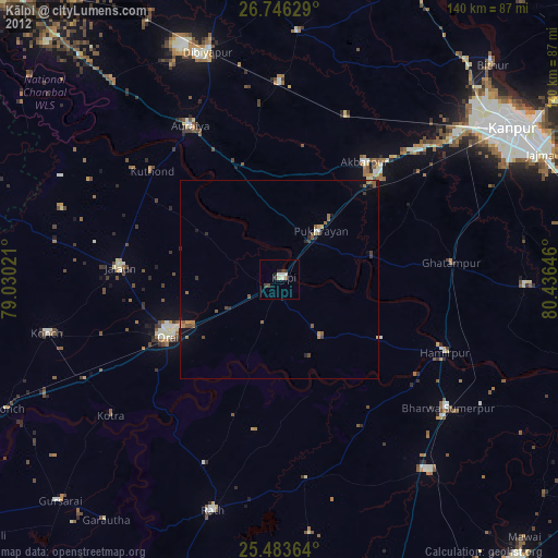
Kālpi night lights from space
Night Light of Kālpi (Uttar Pradesh) from space (India) Src. Average luminocity for 10x10km area is 13.2103% and for 50x50km: 4.2847%.

Analysis of Kālpi night lights 2016
Square area 10x10 km:
 0.99%
0.99%90-99
3.77%80-89
0.79%70-79
1.98%60-69
0.6%50-59
3.17%40-49
1.39%30-39
0.99%20-29
1.39%10-19
1.98%0-9
82.94%Square area 50x50 km:
0.29%90-99
0.59%80-89
0.48%70-79
0.25%60-69
0.46%50-59
0.71%40-49
0.79%30-39
0.96%20-29
1.02%10-19
2.94%0-9
91.52%Clear (daylight) street map image can be seen on geolist.org.
Map coordinates:
26° 44' 46.6" North, 79° 1' 48.8" East
26° 7' 0" North, 79° 43' 60" East
25° 29' 1.1" North, 80° 26' 11.3" East
Some cities around Kālpi sort by population:
• Orai
31.3 km =19.4 mi,  243°
243°
• Jālaun
39.7 km =24.7 mi,  274°
274°
• Pukhrāyān
15.8 km =9.8 mi,  41°
41°
• Akbarpur
36.7 km =22.8 mi, 35°
• Kadaura
18 km =11.2 mi,  144°
144°
• Kurāra
29.8 km =18.5 mi,  120°
120°
• Sikandra
29.7 km =18.5 mi,  339°
339°
• Sarīla
38.3 km =23.8 mi,  188°
188°
1268325 (p: 44,339)
Sources (retrieved 2019-11-25):
» Earth at Night: Flat Maps 2012, 2016