Gulābpura night lights from space
Night Light of Gulābpura (Rajasthan) from space (India) Src. Average luminocity for 10x10km area is 39.6383% and for 50x50km: 5.6719%.
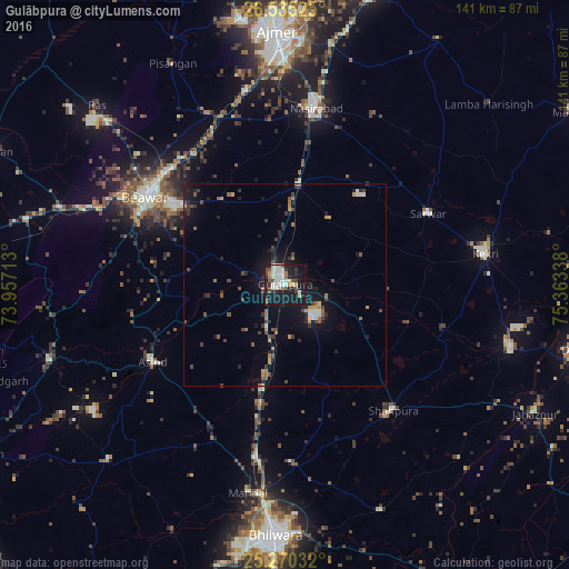
Analysis of Gulābpura night lights 2016
Square area 10x10 km:
 2.46%
2.46%90-99
16.67%80-89
3.6%70-79
1.52%60-69
3.22%50-59
4.73%40-49
6.63%30-39
3.6%20-29
6.06%10-19
47.16%0-9
4.36%Square area 50x50 km:
0.23%90-99
1.01%80-89
0.34%70-79
0.68%60-69
0.65%50-59
0.82%40-49
1.13%30-39
0.97%20-29
1.29%10-19
5.47%0-9
87.42%Clear (daylight) street map image can be seen on geolist.org.
Map coordinates:
26° 32' 6.9" North, 73° 57' 25.7" East
25° 54' 16.1" North, 74° 39' 36.9" East
25° 16' 13.2" North, 75° 21' 48.2" East
Some cities around Gulābpura sort by population:
• Ajmer
60.9 km =37.8 mi,  357°
357°
• Beāwar
40.4 km =25.1 mi,  302°
302°
• Nasīrābād
45.1 km =28 mi,  9°
9°
• Kekri
49.5 km =30.8 mi,  81°
81°
• Shāhpura
41.2 km =25.6 mi,  139°
139°
• Māndal
52.3 km =32.5 mi,  189°
189°
• Sarwār
39.2 km =24.4 mi,  63°
63°
• Āsind
37.9 km =23.5 mi,  239°
239°
1270763 (p: 26,467)
Sources (retrieved 2019-11-25):
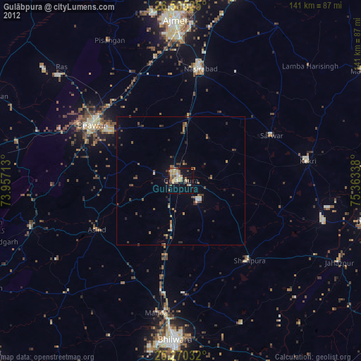
» Earth at Night: Flat Maps 2012, 2016