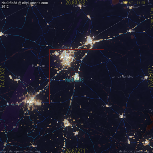
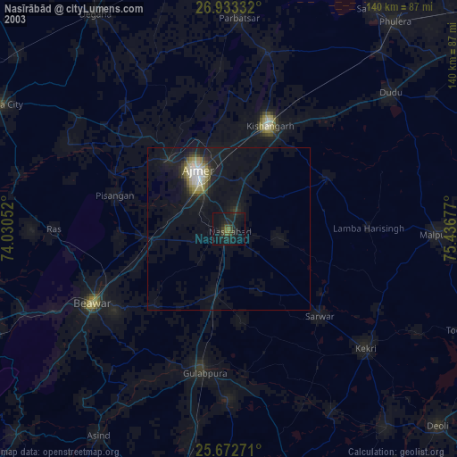
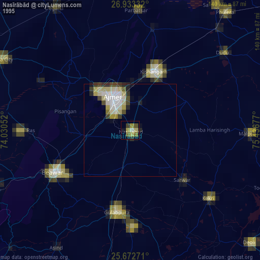
Nasīrābād night lights from space
Night Light of Nasīrābād (Rajasthan) from space (India) Src. Average luminocity for 10x10km area is 38.3095% and for 50x50km: 15.6048%.

Analysis of Nasīrābād night lights 2016
Square area 10x10 km:
 4.76%
4.76%90-99
10.91%80-89
3.77%70-79
3.57%60-69
1.59%50-59
6.15%40-49
4.56%30-39
5.16%20-29
8.73%10-19
45.83%0-9
4.96%Square area 50x50 km:
1.64%90-99
3.67%80-89
1.42%70-79
1.41%60-69
1.63%50-59
2.92%40-49
2.84%30-39
2.83%20-29
4.41%10-19
9.83%0-9
67.39%Clear (daylight) street map image can be seen on geolist.org.
Map coordinates:
26° 55' 60" North, 74° 1' 49.9" East
26° 18' 17" North, 74° 44' 1.1" East
25° 40' 21.8" North, 75° 26' 12.4" East
Some cities around Nasīrābād sort by population:
• Ajmer
18.9 km =11.7 mi,  330°
330°
• Kishangarh
33.9 km =21.1 mi,  20°
20°
• Beāwar
47 km =29.2 mi,  241°
241°
• Kekri
55.7 km =34.6 mi,  131°
131°
• Gulābpura
45.1 km =28 mi,  189°
189°
• Sarwār
38.6 km =24 mi, 134°
• Pushkar
27.4 km =17 mi,  318°
318°
• Uniāra
50.9 km =31.6 mi,  109°
109°
1261727 (p: 51,747)
Sources (retrieved 2019-11-25):
» NASA, Earths city lights 1995
» NASA city lights 2003
» Earth at Night: Flat Maps 2012, 2016