Māndal night lights from space
Night Light of Māndal (Rajasthan) from space (India) Src. Average luminocity for 10x10km area is 25.7976% and for 50x50km: 12.1526%.
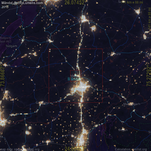
Analysis of Māndal night lights 2016
Square area 10x10 km:
 0.6%
0.6%90-99
3.97%80-89
3.37%70-79
3.17%60-69
2.58%50-59
5.56%40-49
6.15%30-39
3.57%20-29
11.31%10-19
24.8%0-9
34.92%Square area 50x50 km:
1.15%90-99
2.89%80-89
1.09%70-79
1.15%60-69
1.29%50-59
2.08%40-49
2.34%30-39
1.92%20-29
4.49%10-19
6.35%0-9
75.26%Clear (daylight) street map image can be seen on geolist.org.
Map coordinates:
26° 4' 28.3" North, 73° 52' 0" East
25° 26' 28.5" North, 74° 34' 11.2" East
24° 48' 16.8" North, 75° 16' 22.5" East
Some cities around Māndal sort by population:
• Bhīlwāra
12.7 km =7.9 mi,  145°
145°
• Chittaurgarh
61.6 km =38.3 mi,  174°
174°
• Shāhpura
40.8 km =25.4 mi,  60°
60°
• Gulābpura
52.3 km =32.5 mi,  9°
9°
• Begūn
66.8 km =41.5 mi,  139°
139°
• Gangāpur
39.7 km =24.7 mi,  231°
231°
• Amet
66.4 km =41.3 mi,  256°
256°
• Āsind
40.3 km =25 mi,  323°
323°
1263917 (p: 23,478)
Sources (retrieved 2019-11-25):
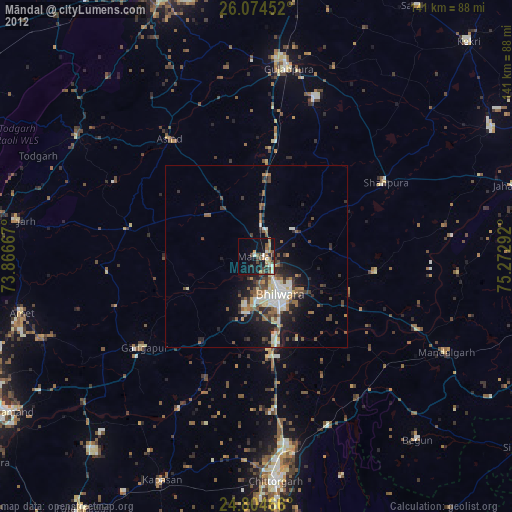
» Earth at Night: Flat Maps 2012, 2016