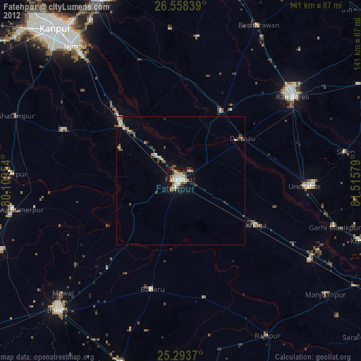
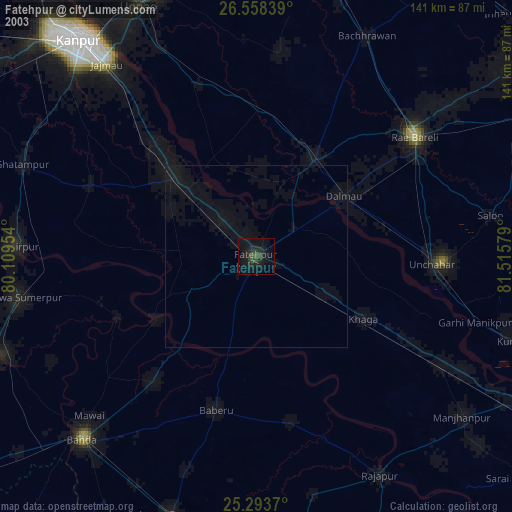
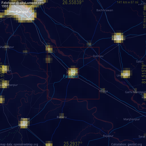
Fatehpur night lights from space
Night Light of Fatehpur (Uttar Pradesh) from space (India) Src. Average luminocity for 10x10km area is 67.6477% and for 50x50km: 13.4713%.
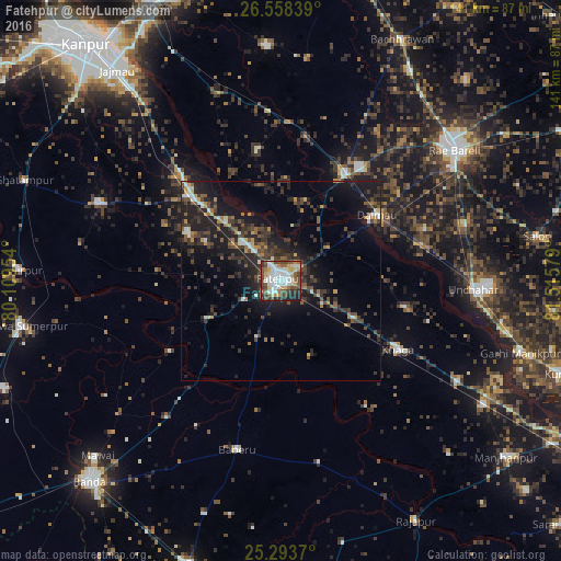
Analysis of Fatehpur night lights 2016
Square area 10x10 km:
 13.83%
90-99
21.21%80-89
8.14%70-79
7.39%60-69
6.44%50-59
9.09%40-49
15.15%30-39
7.01%20-29
8.71%10-19
3.03%0-9
0%Square area 50x50 km:
1.06%90-99
1.78%80-89
0.83%70-79
1.21%60-69
1.46%50-59
1.92%40-49
3.3%30-39
3.99%20-29
5.73%10-19
11.47%0-9
67.23%Clear (daylight) street map image can be seen on geolist.org.
Map coordinates:
26° 33' 30.2" North, 80° 6' 34.3" East
25° 55' 39.9" North, 80° 48' 45.6" East
25° 17' 37.3" North, 81° 30' 56.8" East
Some cities around Fatehpur sort by population:
• Bindki
26.5 km =16.5 mi,  297°
297°
• Baberu
43.7 km =27.2 mi,  194°
194°
• Khāga
33.9 km =21.1 mi,  120°
120°
• Dalmau
26.5 km =16.5 mi,  54°
54°
• Tindwāri
44.8 km =27.8 mi,  219°
219°
• Bahua
21.4 km =13.3 mi,  242°
242°
• Bhagwantnagar
33.4 km =20.8 mi,  350°
350°
• Kishanpur
38.1 km =23.7 mi,  146°
146°
1271912 (p: 166,480)
Sources (retrieved 2019-11-25):
» NASA, Earths city lights 1995
» NASA city lights 2003
» Earth at Night: Flat Maps 2012, 2016