Tindwāri night lights from space
Night Light of Tindwāri (Uttar Pradesh) from space (India) Src. Average luminocity for 10x10km area is 5.0663% and for 50x50km: 5.0374%.
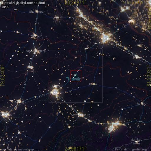
Analysis of Tindwāri night lights 2016
Square area 10x10 km:
 0.95%
0.95%90-99
0.57%80-89
0%70-79
0.76%60-69
0%50-59
1.52%40-49
2.08%30-39
0.19%20-29
1.33%10-19
0.19%0-9
92.42%Square area 50x50 km:
0.69%90-99
1%80-89
0.35%70-79
0.36%60-69
0.51%50-59
0.55%40-49
0.79%30-39
1%20-29
1.73%10-19
3.59%0-9
89.43%Clear (daylight) street map image can be seen on geolist.org.
Map coordinates:
26° 14' 59" North, 79° 49' 26.6" East
25° 37' 2.6" North, 80° 31' 37.8" East
24° 58' 54.2" North, 81° 13' 49.1" East
Some cities around Tindwāri sort by population:
• Bānda
24.8 km =15.4 mi,  231°
231°
• Atarra
37.1 km =23.1 mi,  173°
173°
• Maudaha
42 km =26.1 mi,  280°
280°
• Baberu
19.4 km =12.1 mi,  113°
113°
• Bisenda Buzurg
25.5 km =15.8 mi,  158°
158°
• Bahua
26.5 km =16.5 mi,  21°
21°
• Mataundh
42.3 km =26.3 mi,  241°
241°
• Oran
35.1 km =21.8 mi,  142°
142°
1254442 (p: 10,406)
Sources (retrieved 2019-11-25):
» Earth at Night: Flat Maps 2012, 2016