Dhrāngadhra night lights from space
Night Light of Dhrāngadhra (Gujarat) from space (India) Src. Average luminocity for 10x10km area is 33.0595% and for 50x50km: 4.2332%.
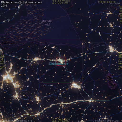
Analysis of Dhrāngadhra night lights 2016
Square area 10x10 km:
 1.19%
1.19%90-99
6.94%80-89
6.15%70-79
4.37%60-69
2.78%50-59
6.94%40-49
5.95%30-39
1.79%20-29
4.17%10-19
45.83%0-9
13.89%Square area 50x50 km:
0.05%90-99
0.34%80-89
0.45%70-79
0.47%60-69
0.6%50-59
1.31%40-49
0.72%30-39
0.65%20-29
0.78%10-19
3.43%0-9
91.21%Clear (daylight) street map image can be seen on geolist.org.
Map coordinates:
23° 38' 14.6" North, 70° 45' 53.3" East
22° 59' 30" North, 71° 28' 4.5" East
22° 20' 34.3" North, 72° 10' 15.8" East
Some cities around Dhrāngadhra sort by population:
• Surendranagar
34.8 km =21.6 mi,  147°
147°
• Morbi
67.4 km =41.9 mi,  253°
253°
• Thān
54 km =33.6 mi,  210°
210°
• Limbdi
59 km =36.7 mi,  143°
143°
• Halvad
29.6 km =18.4 mi,  275°
275°
• Sāyla
49.2 km =30.6 mi,  178°
178°
• Lakhtar
36.1 km =22.4 mi,  114°
114°
• Māndal
56.7 km =35.2 mi,  54°
54°
1272701 (p: 75,578)
Sources (retrieved 2019-11-25):
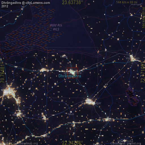
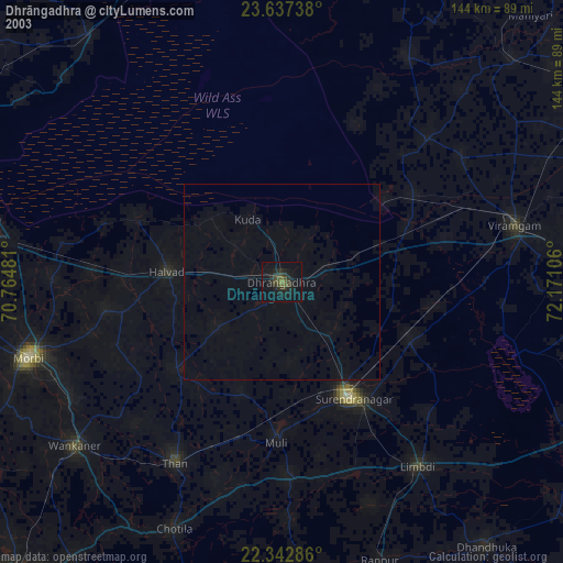
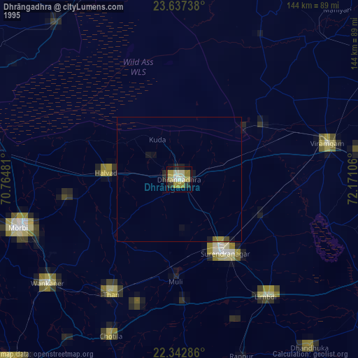
» NASA, Earths city lights 1995
» NASA city lights 2003
» Earth at Night: Flat Maps 2012, 2016