Morbi night lights from space
Night Light of Morbi (Gujarat) from space (India) Src. Average luminocity for 10x10km area is 72.5556% and for 50x50km: 15.1344%.
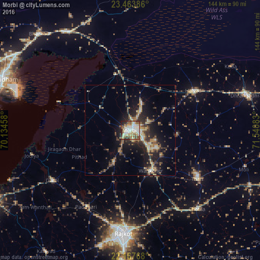
Analysis of Morbi night lights 2016
Square area 10x10 km:
 15.87%
90-99
22.42%80-89
10.71%70-79
8.13%60-69
11.31%50-59
11.51%40-49
6.94%30-39
3.97%20-29
7.14%10-19
1.98%0-9
0%Square area 50x50 km:
0.98%90-99
2.11%80-89
2.13%70-79
1.62%60-69
2.42%50-59
2.61%40-49
2.71%30-39
3.14%20-29
5.04%10-19
9.87%0-9
67.37%Clear (daylight) street map image can be seen on geolist.org.
Map coordinates:
23° 27' 49.9" North, 70° 8' 4.5" East
22° 49' 2.3" North, 70° 50' 15.7" East
22° 10' 3.6" North, 71° 32' 27" East
Some cities around Morbi sort by population:
• Wānkāner
25.3 km =15.7 mi,  154°
154°
• Thān
45.9 km =28.5 mi,  126°
126°
• Dhrol
51.3 km =31.9 mi,  237°
237°
• Halvad
41.4 km =25.7 mi,  57°
57°
• Jodiya Bandar
57.9 km =36 mi,  258°
258°
• Chotila
57.2 km =35.5 mi,  139°
139°
• Tankāra
20.1 km =12.5 mi,  206°
206°
• Paddhari
48.8 km =30.3 mi, 209°
1262775 (p: 118,022)
Sources (retrieved 2019-11-25):
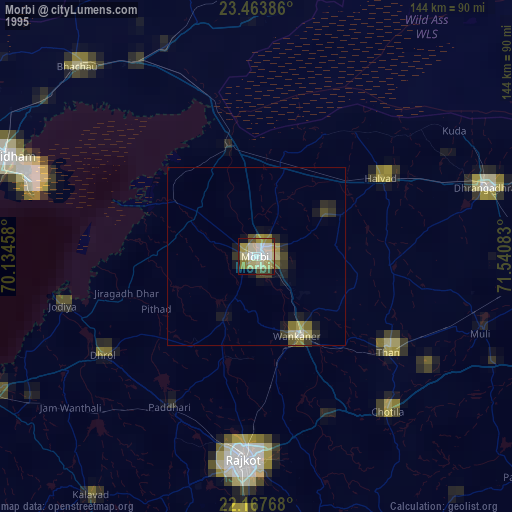
» NASA, Earths city lights 1995
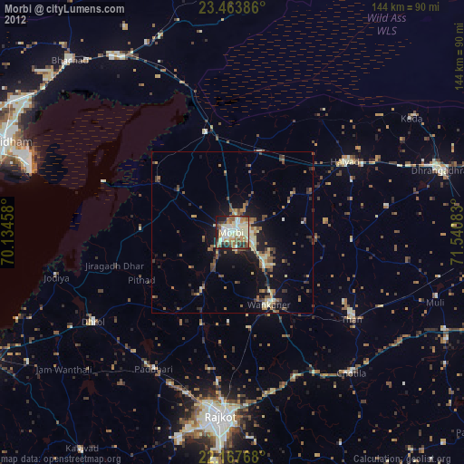
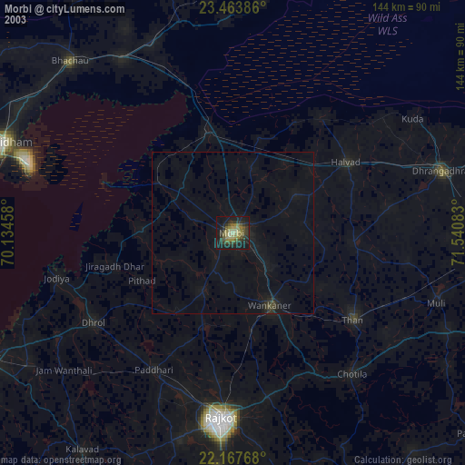
» NASA city lights 2003
» Earth at Night: Flat Maps 2012, 2016