Lakhtar night lights from space
Night Light of Lakhtar (Gujarat) from space (India) Src. Average luminocity for 10x10km area is 4.2758% and for 50x50km: 4.6515%.
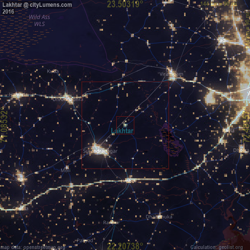
Analysis of Lakhtar night lights 2016
Square area 10x10 km:
 0%
0%90-99
0.2%80-89
1.39%70-79
0.6%60-69
0.2%50-59
0%40-49
0.79%30-39
1.98%20-29
1.98%10-19
0.4%0-9
92.46%Square area 50x50 km:
0.45%90-99
0.7%80-89
0.58%70-79
0.34%60-69
0.52%50-59
0.97%40-49
0.64%30-39
0.67%20-29
1.43%10-19
3.2%0-9
90.5%Clear (daylight) street map image can be seen on geolist.org.
Map coordinates:
23° 30' 11.5" North, 71° 5' 7.2" East
22° 51' 24.6" North, 71° 47' 18.4" East
22° 12' 26.6" North, 72° 29' 29.7" East
Some cities around Lakhtar sort by population:
• Surendranagar
20.3 km =12.6 mi,  224°
224°
• Dhrāngadhra
36.1 km =22.4 mi,  294°
294°
• Limbdi
32.5 km =20.2 mi,  175°
175°
• Sānand
62.6 km =38.9 mi,  76°
76°
• Dhandhuka
56.6 km =35.2 mi,  158°
158°
• Halvad
64.7 km =40.2 mi, 285°
• Sāyla
46.4 km =28.8 mi, 222°
• Māndal
49.8 km =30.9 mi,  15°
15°
1265225 (p: 14,534)
Sources (retrieved 2019-11-25):
» Earth at Night: Flat Maps 2012, 2016