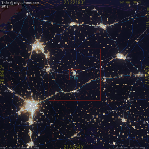
Thān night lights from space
Night Light of Thān (Gujarat) from space (India) Src. Average luminocity for 10x10km area is 27.8788% and for 50x50km: 10.1993%.
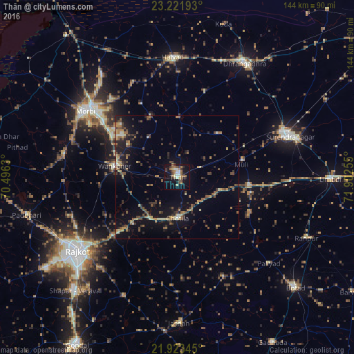
Analysis of Thān night lights 2016
Square area 10x10 km:
 2.08%
2.08%90-99
4.73%80-89
3.03%70-79
2.46%60-69
7.39%50-59
4.73%40-49
3.22%30-39
3.6%20-29
3.6%10-19
28.22%0-9
36.93%Square area 50x50 km:
0.2%90-99
0.71%80-89
1.22%70-79
1.32%60-69
1.62%50-59
1.96%40-49
2.01%30-39
2.4%20-29
2.61%10-19
8.14%0-9
77.82%Clear (daylight) street map image can be seen on geolist.org.
Map coordinates:
23° 13' 18.9" North, 70° 29' 46.7" East
22° 34' 27.2" North, 71° 11' 57.9" East
21° 55' 24.4" North, 71° 54' 9.2" East
Some cities around Thān sort by population:
• Surendranagar
49.1 km =30.5 mi,  69°
69°
• Morbi
45.9 km =28.5 mi,  306°
306°
• Wānkāner
26.6 km =16.5 mi,  279°
279°
• Halvad
49.1 km =30.5 mi,  357°
357°
• Sāyla
29.3 km =18.2 mi,  95°
95°
• Chotila
16.8 km =10.4 mi,  181°
181°
• Vinchia
44.5 km =27.7 mi,  155°
155°
• Tankāra
47.1 km =29.3 mi, 281°
1254675 (p: 42,508)
Sources (retrieved 2019-11-25):
» Earth at Night: Flat Maps 2012, 2016