Dhenkānāl night lights from space
Night Light of Dhenkānāl (Odisha) from space (India) Src. Average luminocity for 10x10km area is 50.3125% and for 50x50km: 17.2332%.
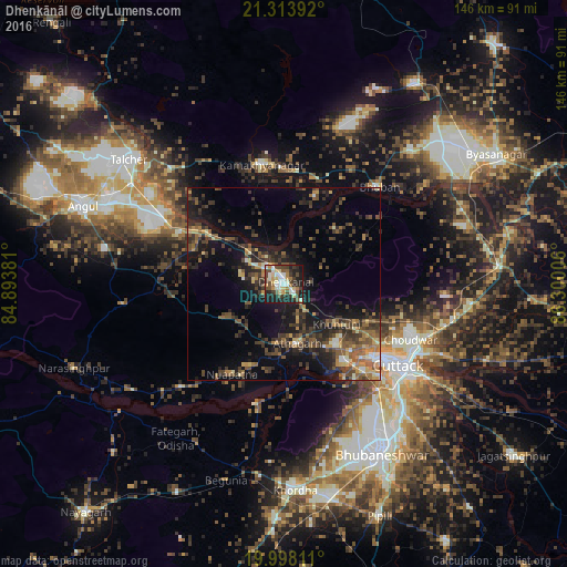


Analysis of Dhenkānāl night lights 2016
Square area 10x10 km:
 4.55%
4.55%90-99
14.39%80-89
5.68%70-79
7.39%60-69
4.92%50-59
5.49%40-49
13.07%30-39
8.71%20-29
15.91%10-19
19.32%0-9
0.57%Square area 50x50 km:
0.52%90-99
1.83%80-89
1.43%70-79
2.14%60-69
2.16%50-59
3.96%40-49
4.7%30-39
5.13%20-29
5.98%10-19
12.32%0-9
59.84%Clear (daylight) street map image can be seen on geolist.org.
Map coordinates:
21° 18' 50.1" North, 84° 53' 37.7" East
20° 39' 26.8" North, 85° 35' 48.9" East
19° 59' 53.2" North, 86° 18' 0.2" East
Some cities around Dhenkānāl sort by population:
• Bhubaneshwar
49.4 km =30.7 mi,  150°
150°
• Cuttack
36.4 km =22.6 mi,  126°
126°
• Khurda
52.8 km =32.8 mi,  177°
177°
• Tālcher
49.8 km =30.9 mi,  310°
310°
• Bhuban
35 km =21.7 mi,  44°
44°
• Āthagarh
15.7 km =9.8 mi,  167°
167°
• Bānki
31.7 km =19.7 mi,  192°
192°
• Kāmākhyānagar
31.2 km =19.4 mi,  350°
350°
1272780 (p: 62,230)
Sources (retrieved 2019-11-25):
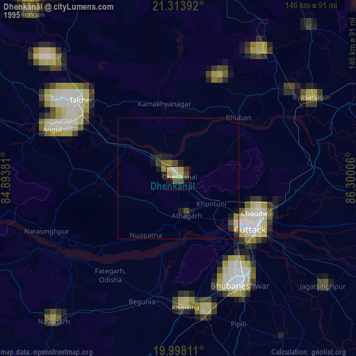
» NASA, Earths city lights 1995
» NASA city lights 2003
» Earth at Night: Flat Maps 2012, 2016