Dharapuram night lights from space
Night Light of Dharapuram (Tamil Nadu) from space (India) Src. Average luminocity for 10x10km area is 22.3698% and for 50x50km: 4.7423%.
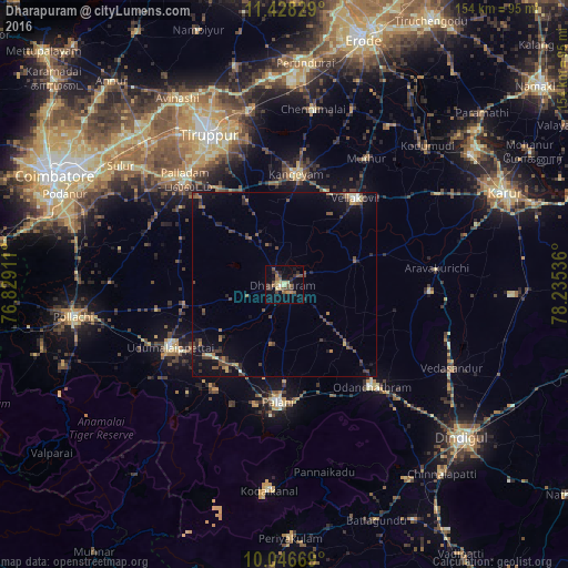
Analysis of Dharapuram night lights 2016
Square area 10x10 km:
 0.21%
0.21%90-99
1.24%80-89
4.55%70-79
3.31%60-69
3.1%50-59
3.93%40-49
6.61%30-39
5.58%20-29
3.72%10-19
11.57%0-9
56.2%Square area 50x50 km:
0.02%90-99
0.33%80-89
0.57%70-79
0.29%60-69
0.68%50-59
0.88%40-49
1.48%30-39
1.21%20-29
1.25%10-19
3.2%0-9
90.1%Clear (daylight) street map image can be seen on geolist.org.
Map coordinates:
11° 25' 41.8" North, 76° 49' 44.8" East
10° 44' 17.8" North, 77° 31' 56" East
10° 2' 48.1" North, 78° 14' 7.3" East
Some cities around Dharapuram sort by population:
• Palani
32 km =19.9 mi,  182°
182°
• Udumalaippettai
35.3 km =21.9 mi,  241°
241°
• Kangayam
29.9 km =18.6 mi,  6°
6°
• Ayakudi
32.1 km =19.9 mi, 176°
• Mūlanūr
20.5 km =12.7 mi,  72°
72°
• Kumaralingam
34.1 km =21.2 mi,  215°
215°
• Periyapatti
28.6 km =17.8 mi,  274°
274°
• Kīranūr
16.4 km =10.2 mi,  191°
191°
1272873 (p: 72,291)
Sources (retrieved 2019-11-25):
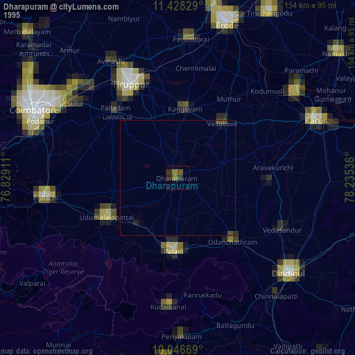
» NASA, Earths city lights 1995
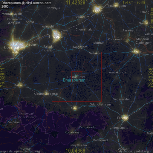
» NASA city lights 2003
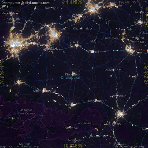
» Earth at Night: Flat Maps 2012, 2016