Chikhli night lights from space
Night Light of Chikhli (Maharashtra) from space (India) Src. Average luminocity for 10x10km area is 16.9015% and for 50x50km: 3.8616%.
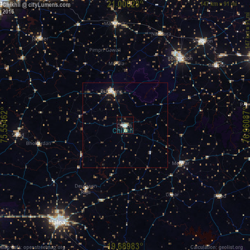
Analysis of Chikhli night lights 2016
Square area 10x10 km:
 2.27%
2.27%90-99
3.79%80-89
1.52%70-79
0%60-69
1.14%50-59
3.41%40-49
2.46%30-39
3.22%20-29
2.65%10-19
5.68%0-9
73.86%Square area 50x50 km:
0.22%90-99
0.46%80-89
0.22%70-79
0.28%60-69
0.57%50-59
0.57%40-49
1.04%30-39
1.01%20-29
0.97%10-19
2.2%0-9
92.46%Clear (daylight) street map image can be seen on geolist.org.
Map coordinates:
21° 0' 29.8" North, 75° 33' 16.6" East
20° 21' 1.7" North, 76° 15' 27.9" East
19° 41' 23.4" North, 76° 57' 39.1" East
Some cities around Chikhli sort by population:
• Khāmgaon
51.2 km =31.8 mi,  39°
39°
• Buldāna
21.3 km =13.2 mi,  339°
339°
• Malkāpur
59.8 km =37.2 mi,  354°
354°
• Sillod
63.3 km =39.3 mi,  265°
265°
• Mehekar
39.3 km =24.4 mi,  124°
124°
• Nāndūra Buzurg
57.7 km =35.9 mi,  21°
21°
• Deūlgaon Rāja
43.6 km =27.1 mi,  211°
211°
• Lonār
49 km =30.4 mi,  145°
145°
1274237 (p: 52,841)
Sources (retrieved 2019-11-25):
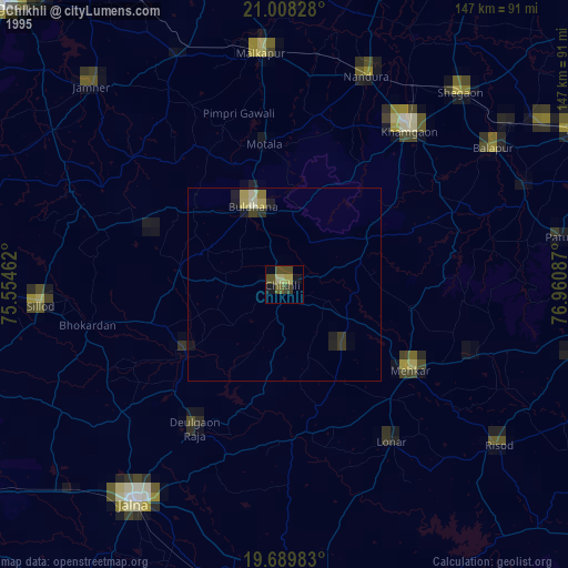
» NASA, Earths city lights 1995
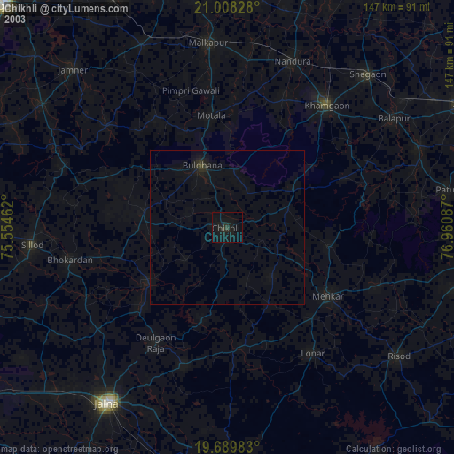
» NASA city lights 2003
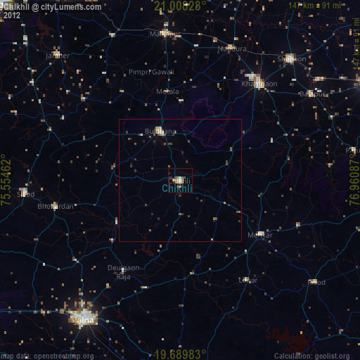
» Earth at Night: Flat Maps 2012, 2016