Sillod night lights from space
Night Light of Sillod (Maharashtra) from space (India) Src. Average luminocity for 10x10km area is 19.3294% and for 50x50km: 2.491%.
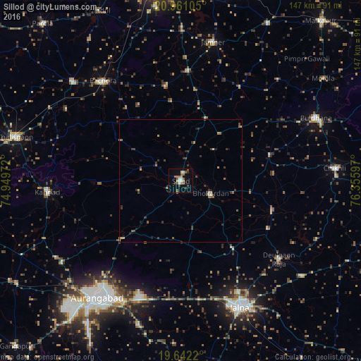
Analysis of Sillod night lights 2016
Square area 10x10 km:
 1.98%
1.98%90-99
2.58%80-89
1.79%70-79
0.79%60-69
5.16%50-59
4.96%40-49
2.98%30-39
1.79%20-29
0.6%10-19
6.35%0-9
71.03%Square area 50x50 km:
0.08%90-99
0.17%80-89
0.19%70-79
0.34%60-69
0.52%50-59
0.45%40-49
0.41%30-39
0.96%20-29
0.49%10-19
0.88%0-9
95.52%Clear (daylight) street map image can be seen on geolist.org.
Map coordinates:
20° 57' 39.8" North, 74° 56' 59" East
20° 18' 10.9" North, 75° 39' 10.2" East
19° 38' 31.9" North, 76° 21' 21.5" East
Some cities around Sillod sort by population:
• Aurangabad
57.4 km =35.7 mi,  214°
214°
• Jālna
56.9 km =35.4 mi,  154°
154°
• Pāchora
51.1 km =31.8 mi,  322°
322°
• Kannad
54 km =33.6 mi,  264°
264°
• Deūlgaon Rāja
51.2 km =31.8 mi,  128°
128°
• Soygaon
32.8 km =20.4 mi,  353°
353°
• Pīpri
57.9 km =36 mi,  192°
192°
• Khuldābād
58.3 km =36.2 mi,  235°
235°
1256269 (p: 51,042)
Sources (retrieved 2019-11-25):
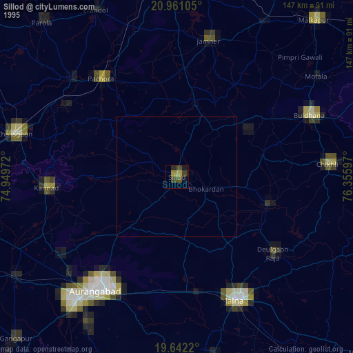
» NASA, Earths city lights 1995
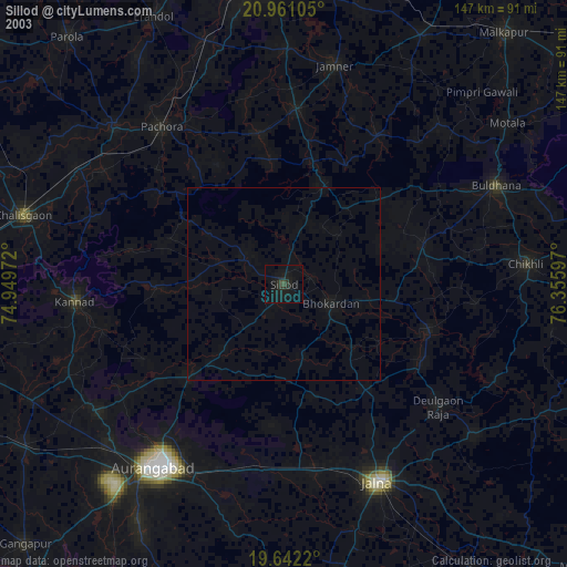
» NASA city lights 2003
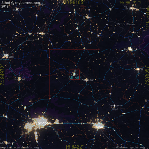
» Earth at Night: Flat Maps 2012, 2016