Lonār night lights from space
Night Light of Lonār (Maharashtra) from space (India) Src. Average luminocity for 10x10km area is 6.2619% and for 50x50km: 3.147%.
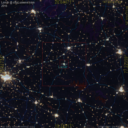
Analysis of Lonār night lights 2016
Square area 10x10 km:
100  0.99%
0.99%
90-99 0.6%
80-89 0%
70-79 0.2%
60-69 1.98%
50-59 0.2%
40-49 2.38%
30-39 0.2%
20-29 1.59%
10-19 2.58%
0-9 89.29%
0.99%90-99
0.6%80-89
0%70-79
0.2%60-69
1.98%50-59
0.2%40-49
2.38%30-39
0.2%20-29
1.59%10-19
2.58%0-9
89.29%Square area 50x50 km:
100 0.15%
90-99 0.27%
80-89 0.14%
70-79 0.14%
60-69 0.64%
50-59 0.65%
40-49 0.81%
30-39 1.12%
20-29 0.82%
10-19 0.88%
0-9 94.39%
0.15%90-99
0.27%80-89
0.14%70-79
0.14%60-69
0.64%50-59
0.65%40-49
0.81%30-39
1.12%20-29
0.82%10-19
0.88%0-9
94.39%Clear (daylight) street map image can be seen on geolist.org.
Map coordinates:
20° 38' 41" North, 75° 49' 2.4" East
19° 59' 7.2" North, 76° 31' 13.7" East
19° 19' 23.4" North, 77° 13' 24.9" East
Some cities around Lonār sort by population:
• Wāshīm
65.5 km =40.7 mi,  77°
77°
• Chikhli
49 km =30.4 mi,  325°
325°
• Selu
59.5 km =37 mi,  188°
188°
• Jintūr
45 km =28 mi,  157°
157°
• Mehekar
19 km =11.8 mi,  15°
15°
• Partūr
53.5 km =33.2 mi,  216°
216°
• Risod
28 km =17.4 mi,  91°
91°
• Deūlgaon Rāja
50.6 km =31.4 mi,  274°
274°
1264794 (p: 21,765)
Sources (retrieved 2019-11-25):
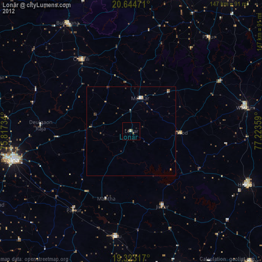
» Earth at Night: Flat Maps 2012, 2016