Bokajān night lights from space
Night Light of Bokajān (Assam) from space (India) Src. Average luminocity for 10x10km area is 11.2004% and for 50x50km: 9.2417%.
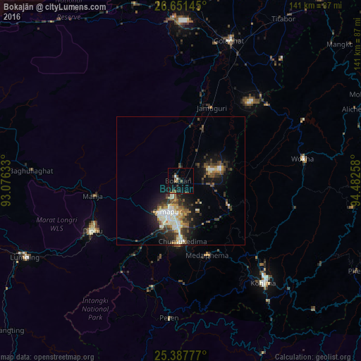
Analysis of Bokajān night lights 2016
Square area 10x10 km:
 0.2%
0.2%90-99
1.39%80-89
0%70-79
0.4%60-69
1.39%50-59
2.98%40-49
3.57%30-39
1.79%20-29
2.18%10-19
12.5%0-9
73.61%Square area 50x50 km:
0.89%90-99
2.38%80-89
0.58%70-79
0.88%60-69
0.9%50-59
1.5%40-49
1.87%30-39
1.64%20-29
2.49%10-19
6.05%0-9
80.81%Clear (daylight) street map image can be seen on geolist.org.
Map coordinates:
26° 39' 5.2" North, 93° 4' 34.8" East
26° 1' 16.7" North, 93° 46' 46" East
25° 23' 16" North, 94° 28' 57.3" East
Some cities around Bokajān sort by population:
• Dimāpur
13.5 km =8.4 mi,  205°
205°
• Kohima
50.9 km =31.6 mi,  139°
139°
• Diphu
40.1 km =24.9 mi,  240°
240°
• Wokha
48.6 km =30.2 mi,  79°
79°
• Golāghāt
57.4 km =35.7 mi,  18°
18°
• Lumding Railway Colony
68.1 km =42.3 mi, 243°
• Barpathār
31.5 km =19.6 mi, 20°
• Numāligarh
67.1 km =41.7 mi,  355°
355°
1275364 (p: 16,561)
Sources (retrieved 2019-11-25):
» Earth at Night: Flat Maps 2012, 2016