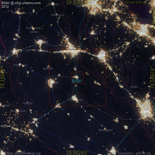
Bilāri night lights from space
Night Light of Bilāri (Uttar Pradesh) from space (India) Src. Average luminocity for 10x10km area is 34.7595% and for 50x50km: 24.9817%.
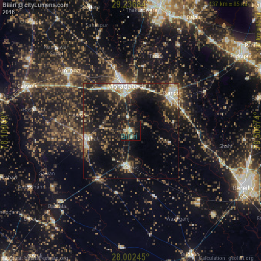
Analysis of Bilāri night lights 2016
Square area 10x10 km:
 1.89%
1.89%90-99
4.17%80-89
5.11%70-79
2.08%60-69
3.79%50-59
9.47%40-49
6.06%30-39
10.04%20-29
15.91%10-19
33.33%0-9
8.14%Square area 50x50 km:
2.25%90-99
3.7%80-89
3.39%70-79
1.92%60-69
2.23%50-59
3.58%40-49
5.68%30-39
6.5%20-29
9.72%10-19
21.73%0-9
39.31%Clear (daylight) street map image can be seen on geolist.org.
Map coordinates:
29° 14' 12.6" North, 78° 6' 1.8" East
28° 37' 17.3" North, 78° 48' 13" East
28° 0' 8.8" North, 79° 30' 24.3" East
Some cities around Bilāri sort by population:
• Morādābād
24.3 km =15.1 mi,  353°
353°
• Rāmpur
30.2 km =18.8 mi,  46°
46°
• Sambhal
23.2 km =14.4 mi,  259°
259°
• Chanduasi
19 km =11.8 mi,  186°
186°
• Shāhābād
21 km =13 mi,  106°
106°
• Kundarkhi
7.1 km =4.4 mi, 345°
• Sirsi
15.8 km =9.8 mi,  277°
277°
• Narauli
17.4 km =10.8 mi,  209°
209°
1275646 (p: 29,666)
Sources (retrieved 2019-11-25):
» Earth at Night: Flat Maps 2012, 2016