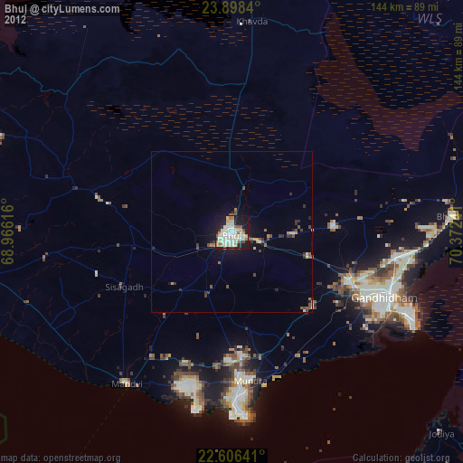
Bhuj night lights from space
Night Light of Bhuj (Gujarat) from space (India) Src. Average luminocity for 10x10km area is 63.7803% and for 50x50km: 6.5563%.

Analysis of Bhuj night lights 2016
Square area 10x10 km:
 14.2%
14.2%90-99
19.51%80-89
12.12%70-79
5.49%60-69
5.3%50-59
5.68%40-49
3.98%30-39
7.39%20-29
16.67%10-19
9.47%0-9
0.19%Square area 50x50 km:
0.63%90-99
1.08%80-89
0.82%70-79
0.58%60-69
0.68%50-59
1.27%40-49
1.05%30-39
1.04%20-29
1.71%10-19
4.36%0-9
86.77%Clear (daylight) street map image can be seen on geolist.org.
Map coordinates:
23° 53' 54.2" North, 68° 57' 58.2" East
23° 15' 14.3" North, 69° 40' 9.4" East
22° 36' 23.1" North, 70° 22' 20.7" East
Some cities around Bhuj sort by population:
• Gāndhīdhām
51.1 km =31.8 mi,  111°
111°
• Anjār
39.7 km =24.7 mi, 113°
• Māndvi
57 km =35.4 mi,  214°
214°
• Kāndla
61.1 km =38 mi, 113°
• Bhachāu
69 km =42.9 mi,  85°
85°
• Mundra
46.4 km =28.8 mi,  173°
173°
• Naliya
86.1 km =53.5 mi,  270°
270°
• Roha
41.2 km =25.6 mi,  261°
261°
1275812 (p: 133,459)
Sources (retrieved 2019-11-25):
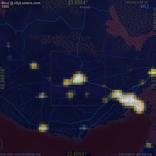
» NASA, Earths city lights 1995
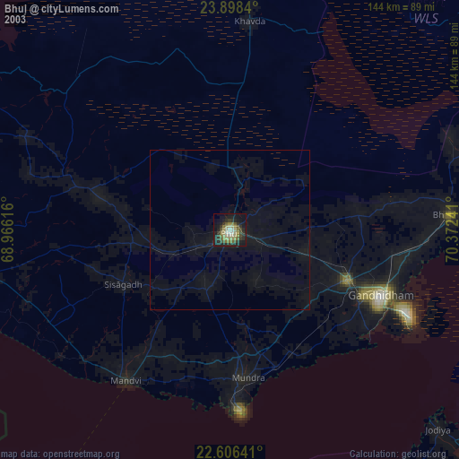
» NASA city lights 2003
» Earth at Night: Flat Maps 2012, 2016