Gāndhīdhām night lights from space
Night Light of Gāndhīdhām (Gujarat) from space (India) Src. Average luminocity for 10x10km area is 88.1364% and for 50x50km: 20.6161%.
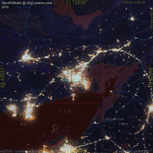
Analysis of Gāndhīdhām night lights 2016
Square area 10x10 km:
 26.7%
26.7%90-99
32.2%80-89
13.45%70-79
13.45%60-69
10.04%50-59
4.17%40-49
0%30-39
0%20-29
0%10-19
0%0-9
0%Square area 50x50 km:
2.53%90-99
4.39%80-89
2.35%70-79
2.51%60-69
2.79%50-59
3.65%40-49
2.94%30-39
2.75%20-29
4.85%10-19
11.24%0-9
59.99%Clear (daylight) street map image can be seen on geolist.org.
Map coordinates:
23° 43' 42.9" North, 69° 25' 48.8" East
23° 4' 60" North, 70° 7' 60" East
22° 26' 5.9" North, 70° 50' 11.3" East
Some cities around Gāndhīdhām sort by population:
• Bhuj
51.1 km =31.8 mi,  291°
291°
• Anjār
11.4 km =7.1 mi, 286°
• Dhrol
64.4 km =40 mi,  153°
153°
• Kāndla
10.2 km =6.3 mi,  123°
123°
• Bhachāu
32.1 km =19.9 mi,  41°
41°
• Bedi
65.4 km =40.6 mi,  188°
188°
• Jodiya Bandar
43.6 km =27.1 mi,  159°
159°
• Mundra
50.1 km =31.1 mi,  237°
237°
1271717 (p: 166,388)
Sources (retrieved 2019-11-25):
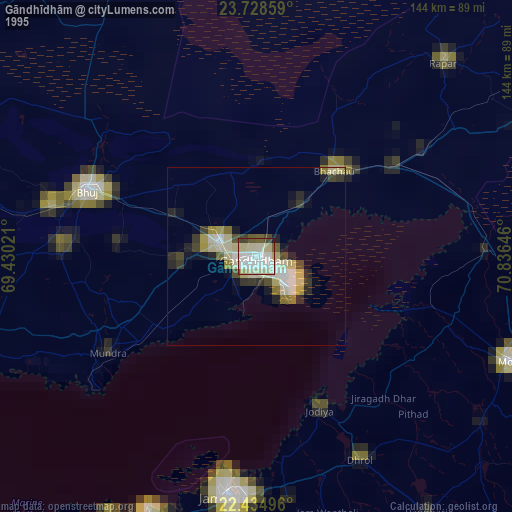
» NASA, Earths city lights 1995
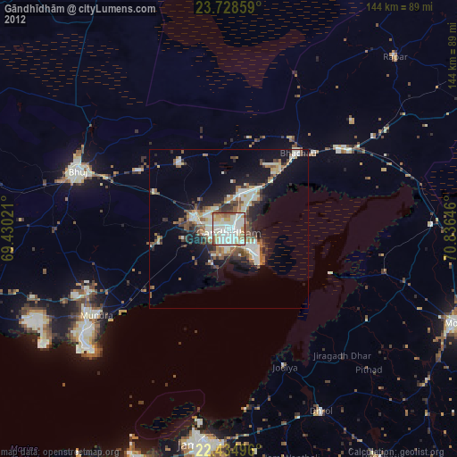
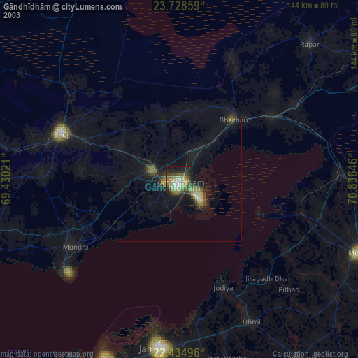
» NASA city lights 2003
» Earth at Night: Flat Maps 2012, 2016