Naliya night lights from space
Night Light of Naliya (Gujarat) from space (India) Src. Average luminocity for 10x10km area is 2.928% and for 50x50km: 1.4565%.
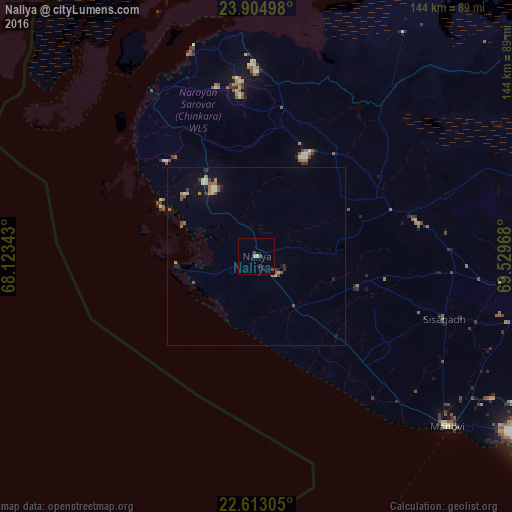
Analysis of Naliya night lights 2016
Square area 10x10 km:
100  0%
0%
90-99 0%
80-89 0%
70-79 1.14%
60-69 0.38%
50-59 0%
40-49 0.76%
30-39 2.27%
20-29 0.76%
10-19 0%
0-9 94.7%
0%90-99
0%80-89
0%70-79
1.14%60-69
0.38%50-59
0%40-49
0.76%30-39
2.27%20-29
0.76%10-19
0%0-9
94.7%Square area 50x50 km:
100 0.06%
90-99 0.14%
80-89 0.2%
70-79 0.13%
60-69 0.24%
50-59 0.32%
40-49 0.27%
30-39 0.24%
20-29 0.31%
10-19 0.33%
0-9 97.76%
0.06%90-99
0.14%80-89
0.2%70-79
0.13%60-69
0.24%50-59
0.32%40-49
0.27%30-39
0.24%20-29
0.31%10-19
0.33%0-9
97.76%Clear (daylight) street map image can be seen on geolist.org.
Map coordinates:
23° 54' 17.9" North, 68° 7' 24.3" East
23° 15' 38.1" North, 68° 49' 35.6" East
22° 36' 47" North, 69° 31' 46.8" East
Some cities around Naliya sort by population:
• Bhuj
86.1 km =53.5 mi,  90°
90°
• Anjār
123.8 km =76.9 mi,  97°
97°
• Māndvi
71.8 km =44.6 mi,  131°
131°
• Dwārka
114.5 km =71.1 mi,  172°
172°
• Okha
91.6 km =56.9 mi,  164°
164°
• Mundra
102.9 km =63.9 mi,  117°
117°
• Dayapar
42.2 km =26.2 mi,  10°
10°
• Roha
45.9 km =28.5 mi, 98°
1262062 (p: 10,587)
Sources (retrieved 2019-11-25):
» Earth at Night: Flat Maps 2012, 2016