Kāndla night lights from space
Night Light of Kāndla (Gujarat) from space (India) Src. Average luminocity for 10x10km area is 60.1587% and for 50x50km: 17.6267%.
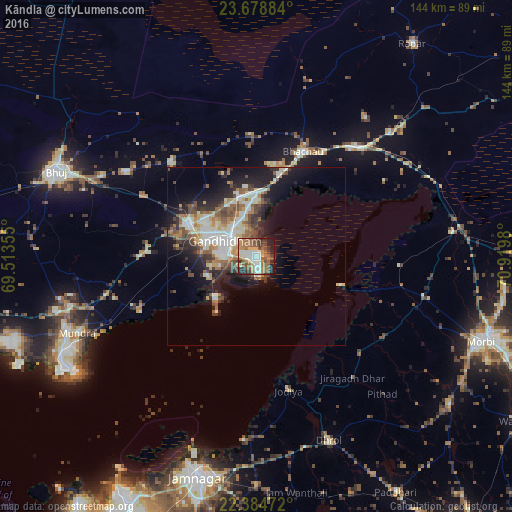
Analysis of Kāndla night lights 2016
Square area 10x10 km:
 8.93%
8.93%90-99
14.09%80-89
2.58%70-79
11.9%60-69
12.5%50-59
14.09%40-49
10.12%30-39
8.33%20-29
8.93%10-19
8.33%0-9
0.2%Square area 50x50 km:
2.41%90-99
3.93%80-89
2.01%70-79
2.01%60-69
2.37%50-59
2.98%40-49
2.73%30-39
2.39%20-29
4.35%10-19
9.21%0-9
65.6%Clear (daylight) street map image can be seen on geolist.org.
Map coordinates:
23° 40' 43.8" North, 69° 30' 48.8" East
23° 1' 60" North, 70° 13' 0" East
22° 23' 5" North, 70° 55' 11.3" East
Some cities around Kāndla sort by population:
• Gāndhīdhām
10.2 km =6.3 mi,  303°
303°
• Bhuj
61.1 km =38 mi,  293°
293°
• Anjār
21.4 km =13.3 mi, 294°
• Dhrol
55.8 km =34.7 mi,  158°
158°
• Bhachāu
32.2 km =20 mi,  23°
23°
• Bedi
61.7 km =38.3 mi,  196°
196°
• Jodiya Bandar
35.9 km =22.3 mi,  169°
169°
• Mundra
55.1 km =34.2 mi,  246°
246°
1268124 (p: 25,845)
Sources (retrieved 2019-11-25):
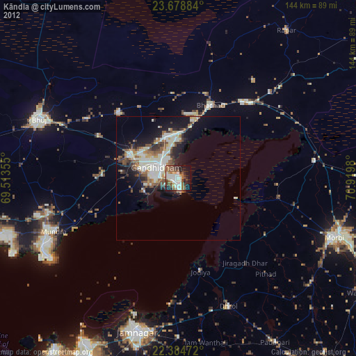
» Earth at Night: Flat Maps 2012, 2016