Bhachāu night lights from space
Night Light of Bhachāu (Gujarat) from space (India) Src. Average luminocity for 10x10km area is 31.7235% and for 50x50km: 11.6778%.
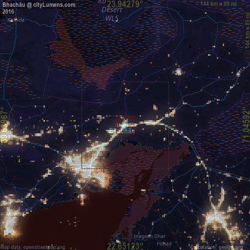
Analysis of Bhachāu night lights 2016
Square area 10x10 km:
 2.08%
2.08%90-99
5.87%80-89
4.17%70-79
3.03%60-69
3.79%50-59
9.09%40-49
3.22%30-39
2.84%20-29
4.55%10-19
45.83%0-9
15.53%Square area 50x50 km:
1.22%90-99
2.33%80-89
1.51%70-79
1.12%60-69
1.45%50-59
2.2%40-49
1.75%30-39
1.23%20-29
2.31%10-19
9.97%0-9
74.9%Clear (daylight) street map image can be seen on geolist.org.
Map coordinates:
23° 56' 34" North, 69° 38' 22.8" East
23° 17' 54.9" North, 70° 20' 34" East
22° 39' 4.4" North, 71° 2' 45.3" East
Some cities around Bhachāu sort by population:
• Gāndhīdhām
32.1 km =19.9 mi,  221°
221°
• Bhuj
69 km =42.9 mi,  265°
265°
• Morbi
73.7 km =45.8 mi,  136°
136°
• Anjār
38.3 km =23.8 mi,  237°
237°
• Kāndla
32.2 km =20 mi,  203°
203°
• Rāpar
43.5 km =27 mi,  45°
45°
• Jodiya Bandar
65 km =40.4 mi,  185°
185°
• Mundra
81.5 km =50.6 mi,  231°
231°
1276370 (p: 24,044)
Sources (retrieved 2019-11-25):
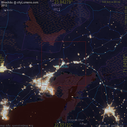
» Earth at Night: Flat Maps 2012, 2016