Sonepur night lights from space
Night Light of Sonepur (Odisha) from space (India) Src. Average luminocity for 10x10km area is 21.7758% and for 50x50km: 2.8089%.
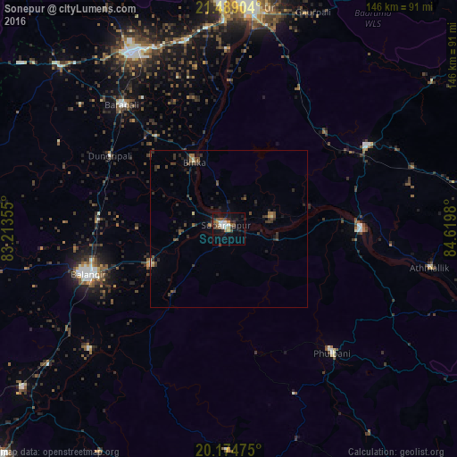
Analysis of Sonepur night lights 2016
Square area 10x10 km:
 2.58%
2.58%90-99
4.56%80-89
0.2%70-79
2.18%60-69
2.78%50-59
3.77%40-49
4.17%30-39
2.98%20-29
6.75%10-19
16.27%0-9
53.77%Square area 50x50 km:
0.11%90-99
0.25%80-89
0.15%70-79
0.14%60-69
0.38%50-59
0.52%40-49
0.77%30-39
0.91%20-29
1.22%10-19
1.36%0-9
94.2%Clear (daylight) street map image can be seen on geolist.org.
Map coordinates:
21° 29' 20.5" North, 83° 12' 48.8" East
20° 49' 60" North, 83° 55' 0" East
20° 10' 29.1" North, 84° 37' 11.3" East
Some cities around Sonepur sort by population:
• Balāngīr
46.6 km =29 mi,  252°
252°
• Bargarh
63.6 km =39.5 mi,  330°
330°
• Phulbāni
51 km =31.7 mi,  140°
140°
• Barpāli
52.4 km =32.6 mi,  319°
319°
• Baud
42.6 km =26.5 mi,  89°
89°
• Binka
24.1 km =15 mi, 333°
• Kaintragarh
65.5 km =40.7 mi,  100°
100°
• Tarabha
27.6 km =17.1 mi, 246°
1255763 (p: 18,768)
Sources (retrieved 2019-11-25):
» Earth at Night: Flat Maps 2012, 2016