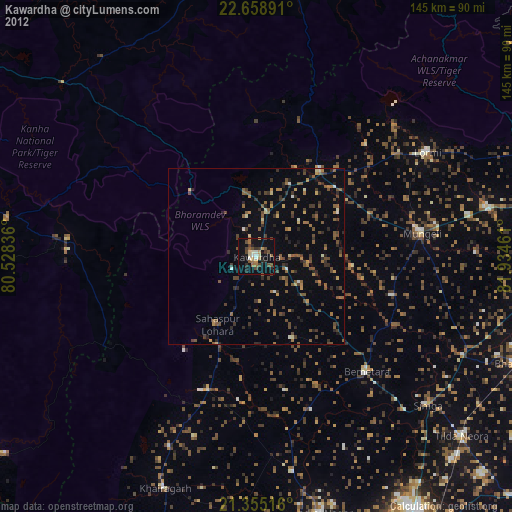
Kawardha night lights from space
Night Light of Kawardha (Chhattisgarh) from space (India) Src. Average luminocity for 10x10km area is 44.3968% and for 50x50km: 18.6738%.
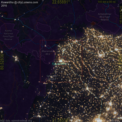
Analysis of Kawardha night lights 2016
Square area 10x10 km:
 4.56%
4.56%90-99
5.36%80-89
6.35%70-79
5.36%60-69
4.56%50-59
13.1%40-49
8.73%30-39
7.14%20-29
27.18%10-19
17.66%0-9
0%Square area 50x50 km:
1.06%90-99
1.41%80-89
1.42%70-79
2.31%60-69
2.68%50-59
4.21%40-49
3.91%30-39
3.43%20-29
8.4%10-19
23.71%0-9
47.45%Clear (daylight) street map image can be seen on geolist.org.
Map coordinates:
22° 39' 32.1" North, 80° 31' 42.1" East
22° 0' 30.7" North, 81° 13' 53.3" East
21° 21' 18.6" North, 81° 56' 4.6" East
Some cities around Kawardha sort by population:
• Mungeli
47.2 km =29.3 mi,  82°
82°
• Bemetāra
45.1 km =28 mi,  136°
136°
• Pandaria
30.3 km =18.8 mi,  37°
37°
• Simga
64.5 km =40.1 mi,  130°
130°
• Lormi
56.7 km =35.2 mi,  58°
58°
• Gandai
40.4 km =25.1 mi,  199°
199°
• Pāndātarai
22.2 km =13.8 mi,  26°
26°
• Chhuīkhadān
59.1 km =36.7 mi, 204°
1267369 (p: 35,238)
Sources (retrieved 2019-11-25):
» Earth at Night: Flat Maps 2012, 2016