Baharampur night lights from space
Night Light of Baharampur (West Bengal) from space (India) Src. Average luminocity for 10x10km area is 74.1761% and for 50x50km: 19.1408%.
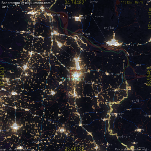
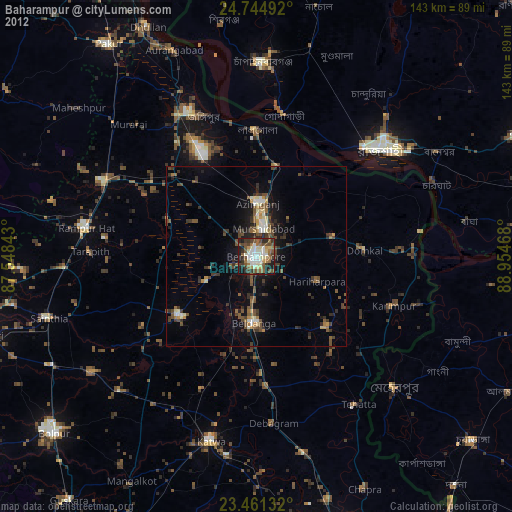
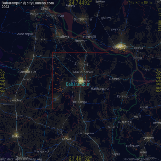
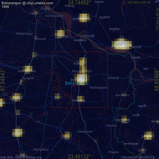
Analysis of Baharampur night lights 2016
Square area 10x10 km:
 14.58%
90-99
27.08%80-89
7.58%70-79
3.79%60-69
13.83%50-59
17.05%40-49
6.82%30-39
5.49%20-29
3.79%10-19
0%0-9
0%Square area 50x50 km:
1.62%90-99
2.67%80-89
1.04%70-79
1.11%60-69
2.21%50-59
4.25%40-49
5.18%30-39
5.23%20-29
6.58%10-19
13.53%0-9
56.58%Clear (daylight) street map image can be seen on geolist.org.
Map coordinates:
24° 44' 41.7" North, 87° 32' 54.3" East
24° 6' 17" North, 88° 15' 5.6" East
23° 27' 40.8" North, 88° 57' 16.8" East
Some cities around Baharampur sort by population:
• Rājshāhi, BD
46.4 km =28.8 mi,  49°
49°
• Jangipur
44.3 km =27.5 mi,  336°
336°
• Kāndi
26.9 km =16.7 mi,  233°
233°
• Murshidābād
9 km =5.6 mi,  13°
13°
• Lālgola
35.3 km =21.9 mi,  0°
0°
• Beldānga
19 km =11.8 mi,  177°
177°
• Debīpur
40.6 km =25.2 mi,  66°
66°
• Karīmpur
40 km =24.9 mi,  110°
110°
1277820 (p: 180,547)
Sources (retrieved 2019-11-25):
» NASA, Earths city lights 1995
» NASA city lights 2003
» Earth at Night: Flat Maps 2012, 2016