Attili night lights from space
Night Light of Attili (Andhra Pradesh) from space (India) Src. Average luminocity for 10x10km area is 4.3463% and for 50x50km: 13.2467%.
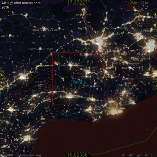
Analysis of Attili night lights 2016
Square area 10x10 km:
 0%
0%90-99
0%80-89
0%70-79
0%60-69
0.87%50-59
0%40-49
1.3%30-39
1.3%20-29
0.43%10-19
5.63%0-9
90.48%Square area 50x50 km:
0.26%90-99
1.53%80-89
0.97%70-79
1.15%60-69
1.43%50-59
2.24%40-49
3.29%30-39
3.29%20-29
4.53%10-19
13.77%0-9
67.56%Clear (daylight) street map image can be seen on geolist.org.
Map coordinates:
17° 22' 20.2" North, 80° 53' 48.8" East
16° 42' 0" North, 81° 36' 0" East
16° 1' 31.3" North, 82° 18' 11.3" East
Some cities around Attili sort by population:
• Bhīmavaram
19.5 km =12.1 mi,  204°
204°
• Tādepallegūdem
14.9 km =9.3 mi,  328°
328°
• Tanuku
10.6 km =6.6 mi,  55°
55°
• Pālakollu
24.6 km =15.3 mi,  145°
145°
• Nidadavole
24.1 km =15 mi,  18°
18°
• Akivīdu
26.7 km =16.6 mi,  240°
240°
• Penugonda
16.3 km =10.1 mi,  108°
108°
• Pippara
5.6 km =3.5 mi,  289°
289°
1278178 (p: 68,196)
Sources (retrieved 2019-11-25):
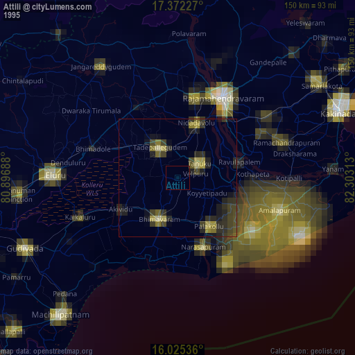
» NASA, Earths city lights 1995
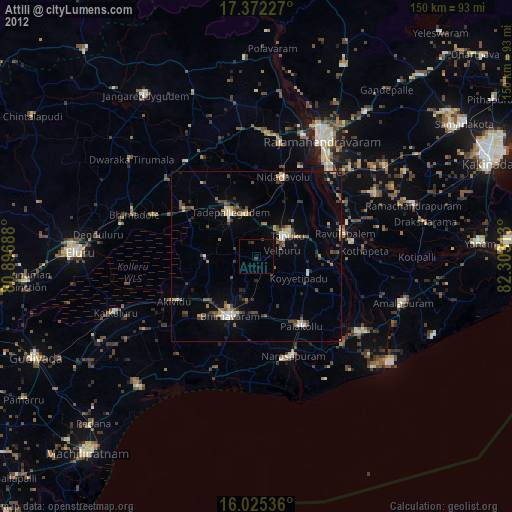
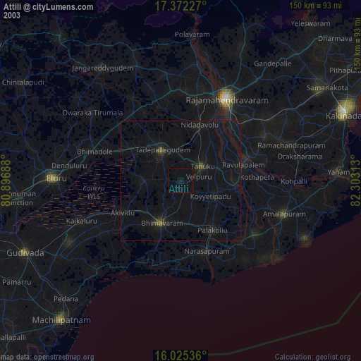
» NASA city lights 2003
» Earth at Night: Flat Maps 2012, 2016