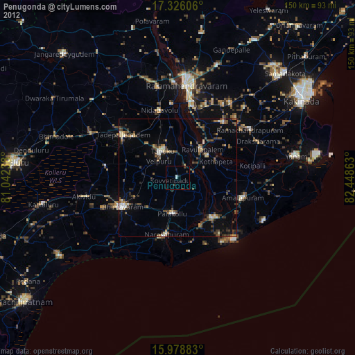
Penugonda night lights from space
Night Light of Penugonda (Andhra Pradesh) from space (India) Src. Average luminocity for 10x10km area is 10.8593% and for 50x50km: 17.5916%.
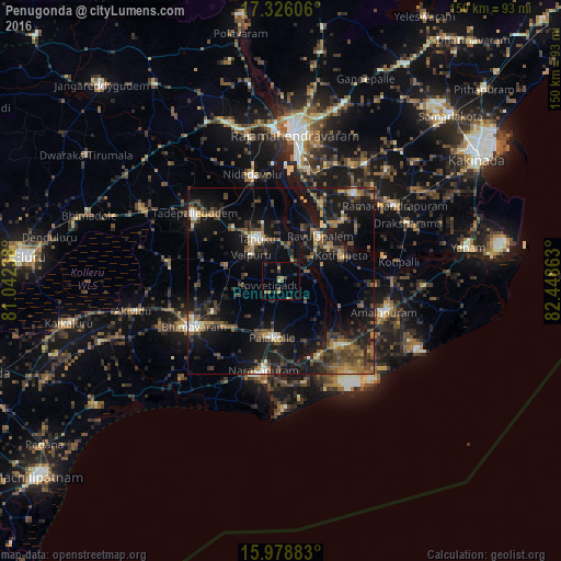
Analysis of Penugonda night lights 2016
Square area 10x10 km:
 0%
0%90-99
0%80-89
1.3%70-79
2.38%60-69
2.16%50-59
1.52%40-49
1.08%30-39
2.81%20-29
4.11%10-19
3.25%0-9
81.39%Square area 50x50 km:
0.38%90-99
1.86%80-89
1.38%70-79
1.71%60-69
2.34%50-59
3.32%40-49
4.86%30-39
4.19%20-29
6.02%10-19
19.78%0-9
54.17%Clear (daylight) street map image can be seen on geolist.org.
Map coordinates:
17° 19' 33.8" North, 81° 2' 32.6" East
16° 39' 13.1" North, 81° 44' 43.8" East
15° 58' 43.8" North, 82° 26' 55.1" East
Some cities around Penugonda sort by population:
• Bhīmavaram
26.8 km =16.7 mi,  242°
242°
• Tanuku
13.1 km =8.1 mi,  328°
328°
• Attili
16.3 km =10.1 mi,  288°
288°
• Narasapur
24.9 km =15.5 mi,  191°
191°
• Pālakollu
15.3 km =9.5 mi, 186°
• Amalāpuram
29 km =18 mi,  106°
106°
• Rāzole
22.1 km =13.7 mi,  153°
153°
• Pippara
22 km =13.7 mi, 288°
1259907 (p: 23,654)
Sources (retrieved 2019-11-25):
» Earth at Night: Flat Maps 2012, 2016