Antu night lights from space
Night Light of Antu (Uttar Pradesh) from space (India) Src. Average luminocity for 10x10km area is 19.498% and for 50x50km: 26.0501%.
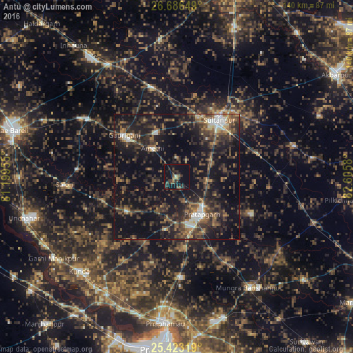
Analysis of Antu night lights 2016
Square area 10x10 km:
 0%
0%90-99
0.79%80-89
0.79%70-79
2.18%60-69
1.19%50-59
3.17%40-49
5.36%30-39
5.75%20-29
12.7%10-19
24.4%0-9
43.65%Square area 50x50 km:
1.58%90-99
2.26%80-89
1.2%70-79
2.07%60-69
3.75%50-59
5.01%40-49
7.59%30-39
9%20-29
11.57%10-19
25.29%0-9
30.67%Clear (daylight) street map image can be seen on geolist.org.
Map coordinates:
26° 41' 11.4" North, 81° 11' 58.4" East
26° 3' 23.5" North, 81° 54' 9.6" East
25° 25' 23.5" North, 82° 36' 20.9" East
Some cities around Antu sort by population:
• Sultānpur
28.1 km =17.5 mi,  37°
37°
• Bela
17.8 km =11.1 mi,  148°
148°
• Lālganj
24.2 km =15 mi,  234°
234°
• Mau Aimma
40.2 km =25 mi,  177°
177°
• Amethī
14.8 km =9.2 mi,  318°
318°
• Pratāpgarh
18.4 km =11.4 mi,  167°
167°
• Patti
33.3 km =20.7 mi,  116°
116°
• Musāfir-Khāna
37.3 km =23.2 mi,  343°
343°
1278515 (p: 8,316)
Sources (retrieved 2019-11-25):
» Earth at Night: Flat Maps 2012, 2016