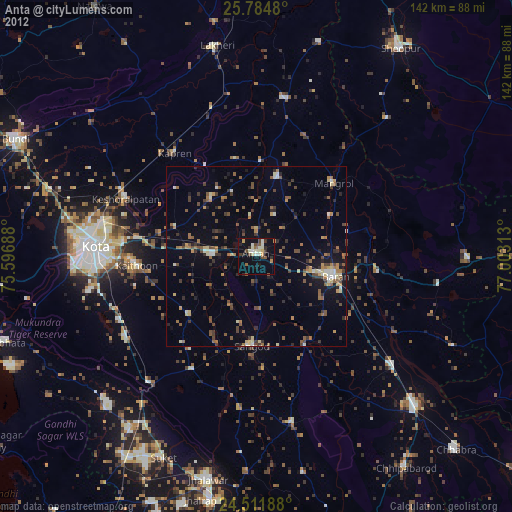
Anta night lights from space
Night Light of Anta (Rajasthan) from space (India) Src. Average luminocity for 10x10km area is 36.678% and for 50x50km: 18.6109%.
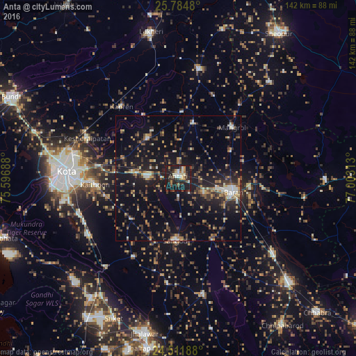
Analysis of Anta night lights 2016
Square area 10x10 km:
 3.79%
3.79%90-99
6.25%80-89
3.41%70-79
4.55%60-69
5.49%50-59
2.46%40-49
5.87%30-39
9.28%20-29
12.31%10-19
45.64%0-9
0.95%Square area 50x50 km:
0.93%90-99
2.18%80-89
1.49%70-79
2.42%60-69
2.18%50-59
2.66%40-49
3.41%30-39
4.55%20-29
5.77%10-19
19%0-9
55.4%Clear (daylight) street map image can be seen on geolist.org.
Map coordinates:
25° 47' 5.3" North, 75° 35' 48.8" East
25° 9' 0" North, 76° 18' 0" East
24° 30' 42.8" North, 77° 0' 11.3" East
Some cities around Anta sort by population:
• Kota
46.5 km =28.9 mi,  274°
274°
• Bārān
22.5 km =14 mi,  104°
104°
• Māngrol
29.1 km =18.1 mi,  46°
46°
• Keshorai Pātan
39.6 km =24.6 mi,  293°
293°
• Sangod
24.8 km =15.4 mi,  183°
183°
• Kāpren
36.3 km =22.6 mi,  321°
321°
• Khānpur
47.4 km =29.5 mi,  168°
168°
• Udpura
56.7 km =35.2 mi,  215°
215°
1278532 (p: 30,598)
Sources (retrieved 2019-11-25):
» Earth at Night: Flat Maps 2012, 2016