Kothi night lights from space
Night Light of Kothi (Madhya Pradesh) from space (India) Src. Average luminocity for 10x10km area is 16.6951% and for 50x50km: 14.4066%.
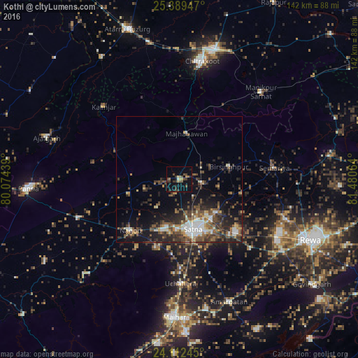
Analysis of Kothi night lights 2016
Square area 10x10 km:
 0.57%
0.57%90-99
0.19%80-89
1.52%70-79
2.27%60-69
2.08%50-59
2.65%40-49
4.55%30-39
7.01%20-29
2.08%10-19
8.9%0-9
68.18%Square area 50x50 km:
1.73%90-99
2.1%80-89
1.13%70-79
1.2%60-69
1.67%50-59
3.04%40-49
3.3%30-39
3.89%20-29
4.49%10-19
7.65%0-9
69.8%Clear (daylight) street map image can be seen on geolist.org.
Map coordinates:
25° 23' 22.1" North, 80° 4' 27.8" East
24° 45' 9.4" North, 80° 46' 39" East
24° 6' 44.8" North, 81° 28' 50.3" East
Some cities around Kothi sort by population:
• Satna
20.1 km =12.5 mi,  165°
165°
• Maihar
54.1 km =33.6 mi,  181°
181°
• Nāgod
28 km =17.4 mi,  223°
223°
• Amarpātan
52.8 km =32.8 mi,  157°
157°
• Mānikpur
47.2 km =29.3 mi,  43°
43°
• Simaria
38.1 km =23.7 mi,  82°
82°
• Kotār
21.4 km =13.3 mi,  106°
106°
• Madhogarh
24.9 km =15.5 mi,  147°
147°
1265983 (p: 7,790)
Sources (retrieved 2019-11-25):
» Earth at Night: Flat Maps 2012, 2016