Ahmadpur night lights from space
Night Light of Ahmadpur (Maharashtra) from space (India) Src. Average luminocity for 10x10km area is 14.0207% and for 50x50km: 3.6801%.
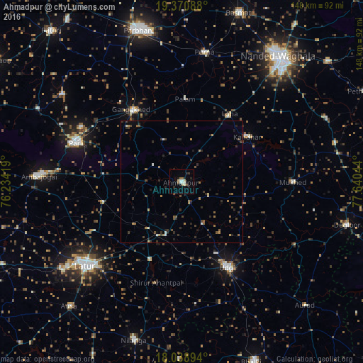
Analysis of Ahmadpur night lights 2016
Square area 10x10 km:
 1.45%
1.45%90-99
2.69%80-89
3.31%70-79
0%60-69
1.65%50-59
1.24%40-49
0.83%30-39
0.83%20-29
3.1%10-19
4.13%0-9
80.79%Square area 50x50 km:
0.11%90-99
0.28%80-89
0.28%70-79
0.37%60-69
0.61%50-59
0.83%40-49
0.8%30-39
0.93%20-29
1.17%10-19
0.8%0-9
93.84%Clear (daylight) street map image can be seen on geolist.org.
Map coordinates:
19° 22' 15.2" North, 76° 14' 3.1" East
18° 42' 22.4" North, 76° 56' 14.3" East
18° 2' 20.2" North, 77° 38' 25.6" East
Some cities around Ahmadpur sort by population:
• Nanded
64.2 km =39.9 mi,  38°
38°
• Latur
51.9 km =32.2 mi,  228°
228°
• Udgīr
39.7 km =24.7 mi,  151°
151°
• Parli Vaijnāth
45.6 km =28.3 mi,  290°
290°
• Ambājogāi
58.1 km =36.1 mi,  272°
272°
• Gangākher
35.3 km =21.9 mi,  325°
325°
• Pūrna
53.7 km =33.4 mi,  9°
9°
• Mukher
45.4 km =28.2 mi,  89°
89°
1279227 (p: 40,218)
Sources (retrieved 2019-11-25):
» Earth at Night: Flat Maps 2012, 2016