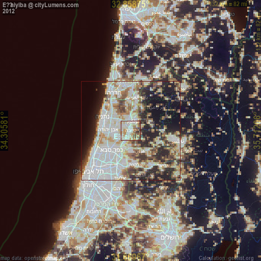
Eṭ Ṭaiyiba night lights from space
Night Light of Eṭ Ṭaiyiba (Central District) from space (Israel) Src. Average luminocity for 10x10km area is 83.2179% and for 50x50km: 62.3583%.
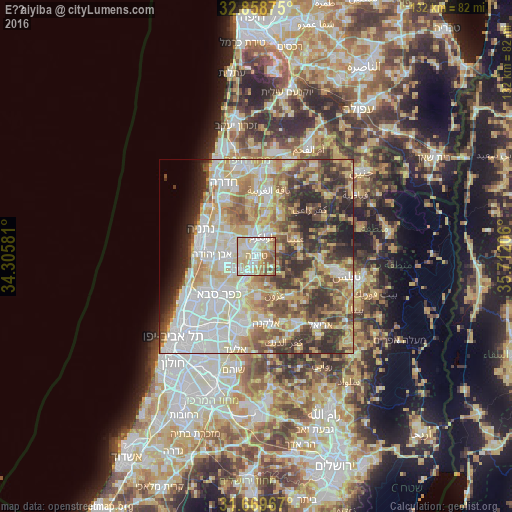
Analysis of Eṭ Ṭaiyiba night lights 2016
Square area 10x10 km:
 19.96%
90-99
21.79%80-89
27.47%70-79
8.42%60-69
8.97%50-59
9.71%40-49
3.66%30-39
0%20-29
0%10-19
0%0-9
0%Square area 50x50 km:
14.29%90-99
14%80-89
12.33%70-79
9.2%60-69
6.63%50-59
7.32%40-49
8.04%30-39
7.48%20-29
9.08%10-19
3.67%0-9
7.97%Clear (daylight) street map image can be seen on geolist.org.
Map coordinates:
32° 51' 31.5" North, 34° 18' 20.9" East
32° 15' 58.2" North, 35° 0' 32.1" East
31° 40' 10.8" North, 35° 42' 43.4" East
Some cities around Eṭ Ṭaiyiba sort by population:
• Ţūlkarm, PS
5.3 km =3.3 mi,  20°
20°
• Qalqīlyah, PS
9.2 km =5.7 mi,  202°
202°
• Kefar Yona
8.9 km =5.5 mi,  308°
308°
• Tirah
6.6 km =4.1 mi,  237°
237°
• Qalansuwa
3.3 km =2.1 mi, 308°
• Tel Mond
8.8 km =5.5 mi,  258°
258°
• Dhannābah, PS
6.1 km =3.8 mi,  30°
30°
• Pardesiyya
10.4 km =6.5 mi,  295°
295°
295130 (p: 32,978)
Sources (retrieved 2019-11-25):
» Earth at Night: Flat Maps 2012, 2016