Dhannābah night lights from space
Night Light of Dhannābah (West Bank) from space (Palestinian Territory) Src. Average luminocity for 10x10km area is 77.3956% and for 50x50km: 63.3245%.
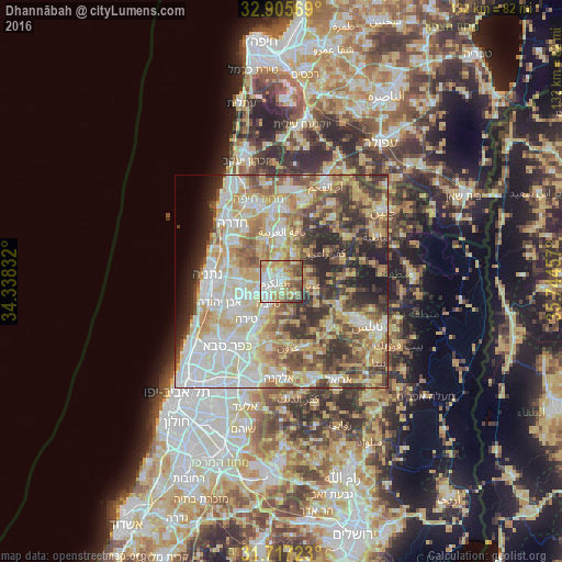
Analysis of Dhannābah night lights 2016
Square area 10x10 km:
 16.3%
16.3%90-99
20.33%80-89
13.74%70-79
15.2%60-69
10.99%50-59
10.44%40-49
10.26%30-39
2.56%20-29
0.18%10-19
0%0-9
0%Square area 50x50 km:
12.37%90-99
14.24%80-89
13.32%70-79
10.21%60-69
7.18%50-59
8.11%40-49
8.59%30-39
7.66%20-29
8.71%10-19
4.22%0-9
5.4%Clear (daylight) street map image can be seen on geolist.org.
Map coordinates:
32° 54' 20.5" North, 34° 20' 18" East
32° 18' 48.3" North, 35° 2' 29.2" East
31° 43' 2" North, 35° 44' 40.5" East
Some cities around Dhannābah sort by population:
• Ţūlkarm
1.3 km =0.8 mi,  254°
254°
• Eṭ Ṭaiyiba, IL
6.1 km =3.8 mi,  210°
210°
• Qalansuwa, IL
6.5 km =4 mi,  240°
240°
• ‘Attīl
6.8 km =4.2 mi,  24°
24°
• Dayr al Ghuşūn
5.5 km =3.4 mi,  37°
37°
• ‘Anabtā
7.1 km =4.4 mi,  94°
94°
• ‘Illār
8.8 km =5.5 mi, 44°
• Bal‘ā
7 km =4.3 mi,  70°
70°
284046 (p: 8,193)
Sources (retrieved 2019-11-25):
» Earth at Night: Flat Maps 2012, 2016