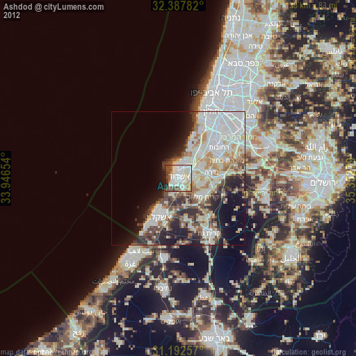
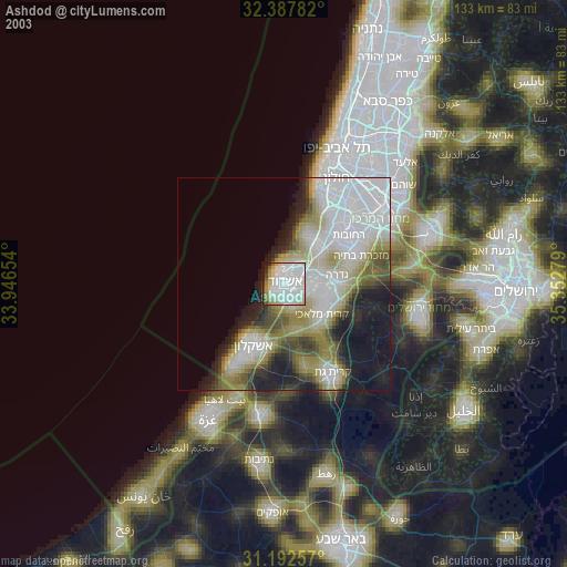
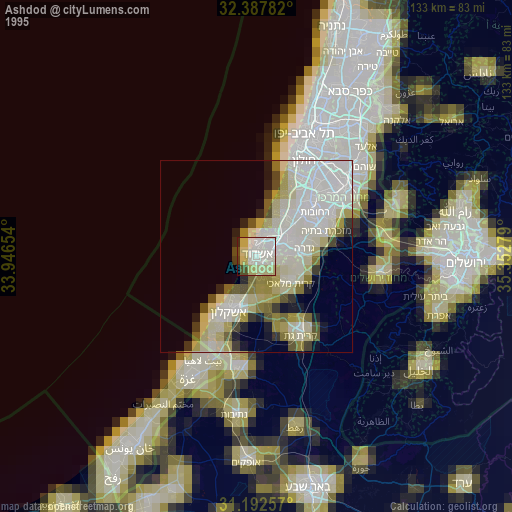
Ashdod night lights from space
Night Light of Ashdod (Southern District) from space (Israel) Src. Average luminocity for 10x10km area is 75.7802% and for 50x50km: 39.9228%.
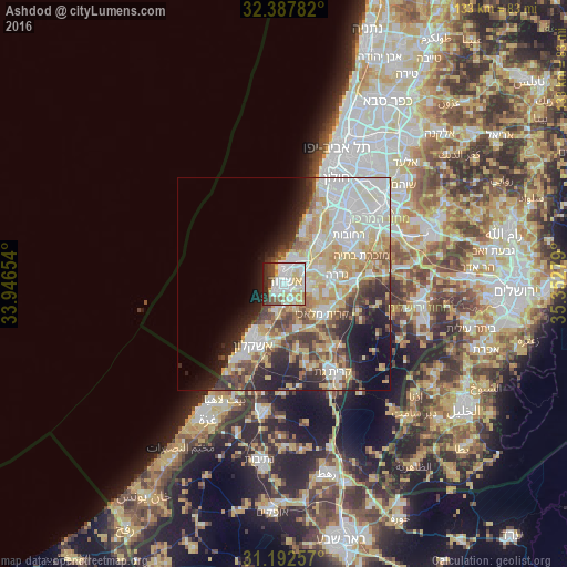
Analysis of Ashdod night lights 2016
Square area 10x10 km:
 26.37%
90-99
22.34%80-89
13%70-79
5.13%60-69
3.85%50-59
5.86%40-49
7.33%30-39
6.23%20-29
7.33%10-19
2.56%0-9
0%Square area 50x50 km:
9.45%90-99
9.05%80-89
7.98%70-79
5.53%60-69
3.23%50-59
3.69%40-49
4.79%30-39
4.43%20-29
6.8%10-19
7.84%0-9
37.2%Clear (daylight) street map image can be seen on geolist.org.
Map coordinates:
32° 23' 16.2" North, 33° 56' 47.5" East
31° 47' 31.7" North, 34° 38' 58.8" East
31° 11' 33.3" North, 35° 21' 10" East
Some cities around Ashdod sort by population:
• Reẖovot
19.1 km =11.9 mi,  53°
53°
• Ashkelon
15.5 km =9.6 mi,  208°
208°
• Ness Ziona
20.8 km =12.9 mi,  42°
42°
• Yavné
12.8 km =8 mi, 41°
• Gedera
12.6 km =7.8 mi,  78°
78°
• Gan Yavne
5.4 km =3.4 mi,  95°
95°
• Mazkeret Batya
19.8 km =12.3 mi,  69°
69°
• Bnei Ayish
9.5 km =5.9 mi, 95°
295629 (p: 224,656)
Sources (retrieved 2019-11-25):
» NASA, Earths city lights 1995
» NASA city lights 2003
» Earth at Night: Flat Maps 2012, 2016