Shankill night lights from space
Night Light of Shankill (Leinster) from space (Ireland) Src. Average luminocity for 10x10km area is 43.8409% and for 50x50km: 19.618%.
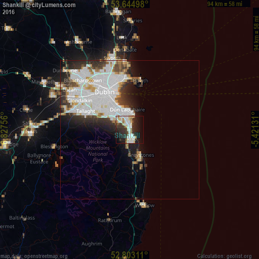
Analysis of Shankill night lights 2016
Square area 10x10 km:
 11.49%
90-99
11.49%80-89
4.8%70-79
2.53%60-69
3.16%50-59
2.4%40-49
3.28%30-39
7.83%20-29
16.54%10-19
20.45%0-9
16.04%Square area 50x50 km:
7.84%90-99
4.88%80-89
1.36%70-79
1.19%60-69
1.18%50-59
1.14%40-49
1.72%30-39
2.3%20-29
4.01%10-19
4.9%0-9
69.48%Clear (daylight) street map image can be seen on geolist.org.
Map coordinates:
53° 38' 41.9" North, 6° 49' 39.2" West
53° 13' 34" North, 6° 7' 28" West
52° 48' 11.2" North, 5° 25' 16.7" West
Some cities around Shankill sort by population:
• Bray
3.1 km =1.9 mi,  146°
146°
• Dún Laoghaire
7.6 km =4.7 mi,  354°
354°
• Foxrock
5.6 km =3.5 mi,  323°
323°
• Cabinteely
5.4 km =3.4 mi,  333°
333°
• Little Bray
2.4 km =1.5 mi,  174°
174°
• Sallynoggin
6 km =3.7 mi, 349°
• Dalkey
6 km =3.7 mi,  15°
15°
• Monkstown
7.7 km =4.8 mi, 345°
2961523 (p: 10,102)
Sources (retrieved 2019-11-25):
» Earth at Night: Flat Maps 2012, 2016