Monkstown night lights from space
Night Light of Monkstown (Leinster) from space (Ireland) Src. Average luminocity for 10x10km area is 62.5896% and for 50x50km: 21.6056%.
Analysis of Monkstown night lights 2016
Square area 10x10 km:
 28.28%
90-99
15.15%80-89
4.55%70-79
3.03%60-69
3.54%50-59
3.54%40-49
5.18%30-39
5.43%20-29
10.73%10-19
14.02%0-9
6.57%Square area 50x50 km:
8.03%90-99
5.05%80-89
1.52%70-79
1.48%60-69
1.46%50-59
1.3%40-49
1.98%30-39
2.47%20-29
4.96%10-19
7.84%0-9
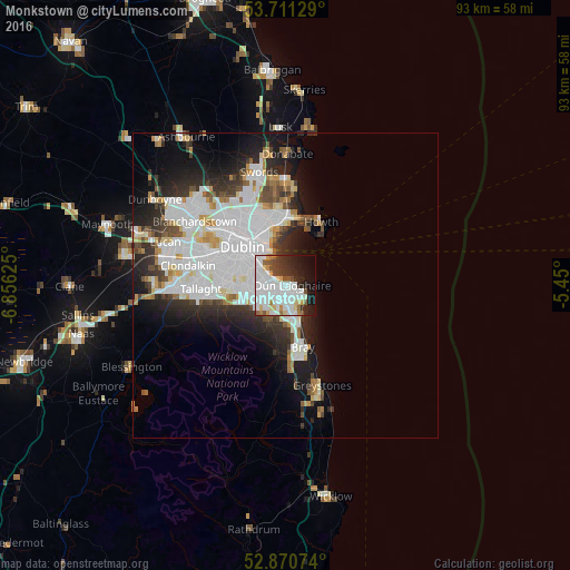
63.91%Clear (daylight) street map image can be seen on geolist.org.
Map coordinates:
53° 42' 40.6" North, 6° 51' 22.5" West
53° 17' 35.1" North, 6° 9' 11.2" West
52° 52' 14.7" North, 5° 27' 0" West
Some cities around Monkstown sort by population:
• Dún Laoghaire
1.2 km =0.7 mi,  85°
85°
• Foxrock
3.3 km =2.1 mi,  205°
205°
• Cabinteely
2.6 km =1.6 mi,  190°
190°
• Blackrock
1.9 km =1.2 mi,  299°
299°
• Mount Merrion
4.2 km =2.6 mi,  280°
280°
• Booterstown
3.4 km =2.1 mi,  292°
292°
• Sallynoggin
1.8 km =1.1 mi,  151°
151°
• Dalkey
3.9 km =2.4 mi,  115°
115°
2962543 (p: 5,555)
Sources (retrieved 2019-11-25):
» Earth at Night: Flat Maps 2012, 2016