Foxrock night lights from space
Night Light of Foxrock (Leinster) from space (Ireland) Src. Average luminocity for 10x10km area is 70.6023% and for 50x50km: 21.5108%.
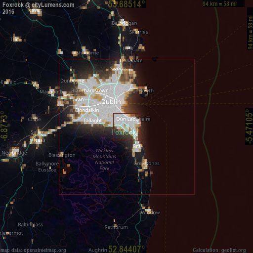
Analysis of Foxrock night lights 2016
Square area 10x10 km:
 32.83%
90-99
18.06%80-89
4.8%70-79
3.16%60-69
3.16%50-59
3.16%40-49
4.92%30-39
9.34%20-29
15.03%10-19
5.43%0-9
0.13%Square area 50x50 km:
8.03%90-99
5.09%80-89
1.51%70-79
1.49%60-69
1.4%50-59
1.33%40-49
1.91%30-39
2.48%20-29
4.85%10-19
7.6%0-9
64.29%Clear (daylight) street map image can be seen on geolist.org.
Map coordinates:
53° 41' 6.5" North, 6° 52' 38.3" West
53° 16' 0" North, 6° 10' 27" West
52° 50' 38.7" North, 5° 28' 15.8" West
Some cities around Foxrock sort by population:
• Dún Laoghaire
4 km =2.5 mi,  40°
40°
• Sandyford
3.5 km =2.2 mi,  284°
284°
• Cabinteely
1 km =0.6 mi,  69°
69°
• Balally
4.2 km =2.6 mi, 282°
• Blackrock
3.9 km =2.4 mi,  356°
356°
• Booterstown
4.5 km =2.8 mi,  337°
337°
• Sallynoggin
2.6 km =1.6 mi,  58°
58°
• Monkstown
3.3 km =2.1 mi,  25°
25°
3315280 (p: 12,870)
Sources (retrieved 2019-11-25):
» Earth at Night: Flat Maps 2012, 2016