Rathgar night lights from space
Night Light of Rathgar (Leinster) from space (Ireland) Src. Average luminocity for 10x10km area is 96.5278% and for 50x50km: 23.6352%.
Analysis of Rathgar night lights 2016
Square area 10x10 km:
 61.99%
90-99
27.15%80-89
4.92%70-79
2.4%60-69
1.39%50-59
0.88%40-49
1.01%30-39
0.25%20-29
0%10-19
0%0-9
0%Square area 50x50 km:
8.21%90-99
5.37%80-89
1.69%70-79
1.71%60-69
1.69%50-59
1.62%40-49
2.2%30-39
2.67%20-29
5.23%10-19
10.06%0-9
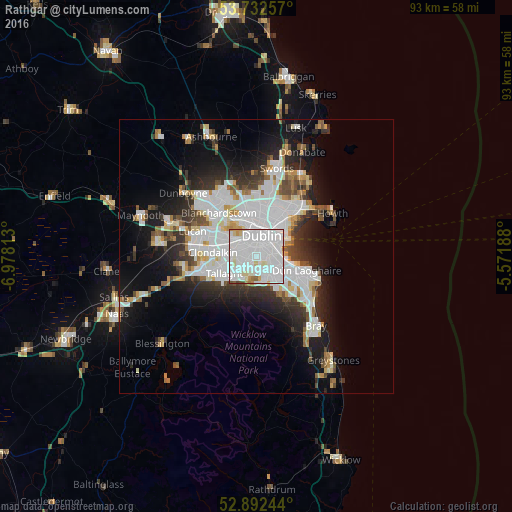
59.55%Clear (daylight) street map image can be seen on geolist.org.
Map coordinates:
53° 43' 57.3" North, 6° 58' 41.3" West
53° 18' 52.5" North, 6° 16' 30" West
52° 53' 32.8" North, 5° 34' 18.8" West
Some cities around Rathgar sort by population:
• Dublin
2.7 km =1.7 mi,  40°
40°
• Dundrum
2.9 km =1.8 mi,  155°
155°
• Crumlin
2.7 km =1.7 mi,  286°
286°
• Rathmines
1 km =0.6 mi,  50°
50°
• Donnybrook
3.5 km =2.2 mi,  91°
91°
• Terenure
0.9 km =0.6 mi,  231°
231°
• Templeogue
3.1 km =1.9 mi, 226°
• Greenhills
2.9 km =1.8 mi,  320°
320°
3315287 (p: 8,394)
Sources (retrieved 2019-11-25):
» Earth at Night: Flat Maps 2012, 2016